Trail Ride Report

Trust Me
Last fall I got a note from Jim LaMonds. He told me that he and his brother Dave were flagging a new trail and asked if I wanted to meet him to scope out the area.
I showed up at the location to find Jim and Daryl, Daryl is one of the major DH riders (a competitive rider). Jim walked us through a section that was probably three quarters of a mile and Daryl flagged areas that looked good for down hill track.
When we got back to our bikes, Jim showed me where the upper section was going to come out and told me that his brother Dave and a friend, Jeff, had flagged part of that section.
A few days later, I decided to ride up and walk the upper flagged area. I asked my friend Bob to come along.
We found the flags and started following them through the woods. This section has smaller timber, in the 15 year age range, from the looks of it.
We crossed a couple of small ridges and came to a stream. The stream was in a small ravine that had a very steep approach from either side.
We made our way across the stream and followed the ribbons through some large, older timber until we reached a gravel road.
Jim had told me that his plan was to use the road to bypass an area that was clear cut. He had identified a haul road that partially crossed the clear cut and was planning on leveraging that to get from his planned starting point to the tall timber.
Neither Bob nor I wanted to ride gravel or the haul road if we could help it so we went back into the timber and started exploring options.
We stumbled through a large section of small timber that had been thinned some time in the last couple of years. The thinned trees were scattered everywhere, making if very hard to maneuver.
After a couple hours of crawling over the thinned timber and scrapping our legs up, we decided to call it a day and come back later for more scouting, again we did not want to ride gravel.
Later I looked over maps and aerial photos for possible routes.
We again headed out to scout for possible trail. We investigated the route through the clear cut that Jim had lined out, clearing and re-marking some of it.
We talked about a short section we had stumbled across on our last scouting adventure and decided to see if we could find it from this end.
After hiking a section of another haul road, in smaller timber, we found the ridge we had climbed up on our last trip.
We both felt it would be better to ride the timber covered haul road and drop over the ridge to find a route to the tall timber.
The clear cut contained a spring fed pond that was surrounded by spruce and ceder trees. Last time we were here, we had wandered through the area and across a narrow, though deep, creek that exited the pond.
This time we were approaching from the other side and located a natural bridge, formed by some rotting logs.
We flagged our way along the edge of the pond and across a short section of clear cut to drop down a steep slope to find another creek, again a narrow deep channel.
We wandered across more clear cut, then decided to take a shot at following the ridge line where we had fought our way through lots of thinned timber.
We found that as long as we stayed close to the edge of the clear cut the thinned stuff was not as thick, we were able to flag a twisting turning line up the ridge to break out and cross a short section of clear cut and enter the large timber about a half mile away from the gravel road.
It was not a complete route but we thought it was better then riding gravel.
Jim organized an advance work party to go in with chain saws to cut out any down timber or thinned stuff in preparation for the big work party.
Bob and I worked the section we had flagged.
We came back later in the week, with a couple friends, to try and find a route to eliminate the haul road. We called on the assistance of a good friend, Vaughn. He had a GPS device that helped us trek through the timber on the shortest route from the end of the first section to our flagged section.
We now had a complete line that would all be single track.
On November 15th Jim had wrangled somewhere around 130 people to show up to move dirt, hack their way through brush and build bridges. There were 8 sections, each had a crew leader who had come out earlier and walked the proposed line.
Each section ended up, in my opinion, reflecting the riding style of the crew leader. If the crew leader was a down hill rider then there were lots of berms and features that would provide opportunity to get air. The crew leaders that were more of a cross country style rider seemed to have more twisting, turning, and rolling lines. Though there was one section put in by a couple of guys that I would have expected the trail to have more DH appeal but turned out to be the most technical section, with lots of twisting, turning, climbing, and large root drops.
Bob and I had lined out a section that would have some real technical challenges.
The first section starts by creating an intersection in the middle of the well established Legacy trail. Then descends through a short section that had some thinning but didn't take a lot of work to move or cut the downed cuttings. It offers some fast, near straight lines with a couple of kickers and an optional log over. Near the end of the section, there is a large pile of cuttings that is an option for testing your log over skills (or I should say, pile of log over skills) a couple of log piles with three options.
The next section starts with a couple of sharp turns around an old stump before roaming through the woods on the top of a ridge.
The line somewhat technical with a short section of log that can be ridden or bounced across and more twisting around stumps before starting a quick shot down the ridge.
The trail then follows the terrain to climb atop a ridge and deposit you at a junction. The junction provides two routes to the same place. The left turn drops through a small pocket to present a couple of turns before traversing the rocky hillside and rejoining the other more technical line on a small flat.
The right turn continues on the top of the ridge until it makes a hard turn to present a very steep, off the saddle with your weight as far back as you can get it, descent down the rubble covered hillside and onto the small flat. And for an extra thrill, there is a large stump roll option at the top of that rubble covered skid line.
The trail continues to traverse the rubble covered hillside before turning and dropping down to the creek crossing.
The bottom of the descent offers up a short skinny for an option and a large old log ride for a second option before turning to follow the edge of the spring fed pond.
The line along the edge of the pond is encrusted with exposed roots. It is somewhat technically challenging with lots of root hopping and tight turns.
The trail turns away from the timber along the edge of the pond and crosses an open area, covered with small fir trees, before dumping you onto a steep that drops some fifty feet to negotiate a bridge. The bridge crosses a narrow creek and exits between a couple of trees. The exit looks very narrow but I have made it with my wide (31 inch) bars.
Another short push across the clear cut puts you at the edge of some young timber and a short punch up before entering the forest canopy.
The trail winds around in the timber to quickly take a turn up the ridge for a hard push on a semi-technical, though short, climb.
Once more the trail enters the clear cut to cross and enter the big timber.
The next section was put in by the Heart family, they cut a line up through the timber. A nice deep woods section that winds around the trees and old stumps, to finish with a short, hard climb, that brings you up to within a few feet of the gravel road.
That section is followed by a section that was laid out by Jerry DeRuyter. It starts with a fast downhill run and offers a couple of kickers before turning to roll over a large log. Jerry cut a passage through the log but it still drops hard on the back side, though very roll-able, just shift your weight back as you roll through the slot.
The trail runs fast before hitting a sharp punch up with a large root to negotiate on the turning climb. I have never made it. I get caught in too high a gear and stall just about the time I hit the root.
From here the trail follows a wide ridge for a short ways before turning to start a quick descent. The line presenting an optional stump over right at the top of the quick blasting descent.
I have seen a couple of guys eat it along here. There are a couple of kickers that I break for, just kind of making a small pop as I hit them. The second one has the potential to launch you off to one side, where a small stump lays hidden, waiting to hammer your front wheel and toss you over the bars.
A short climb ends Jerry's section and offers up Andrews section, some white knuckle down hill thrills.
Rolling over a rocky clump starts the next section of trail.
A fast section of wide single track with a couple of little gaped jumps (the line is wide enough that you can avoid hitting them), has you come screaming through the timber, the first turn approaches. The first corner has a small berm that guides you through as you pick up speed and drop, with a rush, into a wide depression. The opposite side has a medium sized kicker just before the trail crests, it can be a little hard to spot as you come screaming at it. The line is wide here also, so there is the option to swing right or left around the kicker.
The trail drops over the rim and shoots you into another berm that guides you through the turn and launches you at a stump kicker. A small stump that has been cut at an angle, sitting right on the top of a drop, providing a launching point for some. Again the line is plenty wide and the kicker is an option.
The trail drops into a narrow depression as it rolls to the left and pops you up over a sharp edge.
The trail flattens before attacking a good sized roller. The roller leading you into a very steep drop and turn to the right.
The first ride on this trail was the day after it was built. Myself and dozen other riders hit it early on Sunday morning. This section was very green. The steep was a wall of mud and it was all I could do to keep my bike upright. A couple of the riders went down and slid some twenty or more feet before being launched over the berm on the downhill side of the trail and landing in the undergrowth. The trail has matured nicely over this last year and it is now just a very steep skid line. My tactic on this section is to not look at it, it is that steep. When the trail brings me up over the roller, I focus on the trail just a few feet ahead of me. I drop my seat and shift my weight back to lean into the drop and fly down the hill, touching my breaks ever so slightly as the drop launch me down the trail.
The line hammers across the face of the slope with plenty of rolling, pumping action. There are still more little kickers and jumps for those inclined.
A ridge protrudes out from the hillside and the trail follows the contours, wrapping around the point with a little break from the rush before presenting the final part of this section.
A couple of pedal strokes sets you up for the final drop into the creek basin. Andrews plan here was to armor the hillside so you could scream into a wall ride.
On our first ride the trail came to a point where the only option was to drop your ass over the back wheel and fall about twenty feet down the bank to skid across a short flat and up onto a bridge.
Since then Andrew has gone back in and provided an optional line that runs just below the original, making the drop a mere ten feet. I still like the original line.
Once across the bridge the next section is more a cross country kind of trail, starting with a short traverse across a rubble covered section of hillside. The trail carved into the side-hill where if you get off line, there will be a penalty.
The short section of side-hill turns the trail down a root and rock bump line before starting a meandering trek through the woods.
The trail runs up and down a couple of times over some small ridges. Quick punch-ups followed by short fast runs until the trail runs along the edge of a marshy area then makes yet another short hard ascent.
The drop off the back side of this ascent is a bit longer and more technical, with a small stump over at the top and some opportunity for kickers on the fast descent.
The line rolls into the next section which is very technical. The trail makes a quick turn to punch up the hill. It is narrow with a few tight turns before dropping off to the left over a root, a drop of a foot or more into a fast swooping line that shoots down and up before making another hard turn to the right and climbing.
The climbs in this section are hard, steep, punches that will force you into your smaller gears and get you out of the saddle to crank. It is all do-able but the first few times through had me off my bike a couple of times to push the last few feet up.
The final drop out of this section will keep you focused on the narrow line as it twists and turns down a steep hillside and dumps you onto gravel.
A short ride up the road brings you to the next section, another quality downhill run with lots of opportunity for thrills and spills.
A blue flag signals the entrance; an old cat road. The trail follows the cat road down and around a corner before making a sharp left.
There is a large old stump on the right that is roll-able. Up and over or around the stump puts you onto the single track that starts to scream right away.
The line heads straight downhill with a couple of small drops and a kicker to leverage the fun.
A fast right turn has you screaming across the hillside to turn and roll a large old log, buffered both front and back with small log rounds, for an easy, smooth roll.
A couple of quick cranks and a sharp left turn will force you back off the saddle and start you skidding down a steep section that has a narrow berm on the right, followed by a hard right turn through a well banked corner, into a quick left and another fast blast down to bounce off a couple roots where the trail skins past a large alder.
Still carrying speed, the line shoots through a deciduous section of trees and drops you onto a slatted bridge to blast across a wet section and pops you up the bank on the other side.
There is an old log on the left side of the trail for those looking for features to ride, then another big rotted stump feature on the left to roll over before shooting on down the trail.
The line through here rolls up and down, a little cranking, followed by a drop onto another slatted bridge. The bridge twice the length of the last one and an easy kick off the other end to follow the trail up and over another low ridge.
More weaving through the timber on a fast line to slam down a shallow slope and blast across a short bridge before jumping up out of the saddle to punch up a short traverse.
A couple of cranking turns and the trail again starts to scream through the timber, with little pops and turns on a rumbling fast line. There is one little drop here that is very hard to see. The first time I rode this section it almost caught me.
The trail swoops through the timber to make a couple more turns before dumping you onto gravel.
The downhill section of the Trust Me trail is complete.
There are three more sections but for the most part they are all technical climbs. Winding their way through the woods, each section has its own personality.
The first section climbing through the small timber to exit back to the gravel at a stream crossing.
The next section presenting more challenges. Climbing up through a very tough rooty section to twist around and bounce over some logs and finally drop back to the road on a very short track that winds through three banked corners.
The last section has the most climbing, with one short section that will most likely pull you off your bike to push up the hill. Just about the time you feel the trail is going to start running down hill, it turns and climbs some more. Finally leveling off and turning for a short quick run down through the trees to dump you out at the start of the Vortex trail.
For those that don't feel up to the technical climb, you can ride the gravel.
Trust Me! This trail is not for beginners.
I have ridden Trust Me a number of times and it is very challenging. I have ridden it with experienced riders that have told me that they will not ride it again.
This is a trail that you either love or once is enough.
The last day of summer.
The weather man is guessing that we will see rain tomorrow, the first day of fall. And since the trails only have one more dry day, I thought I would hammer out a few miles at Growlers.
I rode a couple of the road side trails over to Carnage (ah I mean Cup Cake). Such sweet lines, the trail architect(s) grabbed every natural feature as the trail descends across the hillside. Delivering up some fun swoops, dips, and quick fast drops. Many of the swooping drops capped with a large root, presenting all kinds of potential for Carnage.
I could hear Without a Paddle calling my name. Though the predominate direction of travel on this trail is down, the climb is very rewarding. I was off my bike to push in just a few places and except for the final climb, none were more then 50 feet of hike a bike. Even the big climb at the upper end was just through the switchbacks, then I was able to do a low gear grind to the top.
Just the thought of the climb up Double Over turned me up the spur road until I hit Double Down.
I climbed the middle leg of Double Down (Yes Double Down has three legs) and came across a swath of florescent orange blazes on the trees.
The forester who had blazed this line had done such a good job of limbing and clearing the line that I was tempted to ride it.
When I reached the gravel, I rode down the road to see if I could spot the blaze line. I didn't.
Now I had no choice, I had to go back and investigate that blaze line.
I found that the blaze line made a 90 degree turn and was posted with a sign that gave the latitude and longitude. This was the corner for a future clear cut. Since I had also stumbled across the other corner last spring, it looks like this operation will either wipe out all or part of five trails. Canoe Log, Ace of Spades, ABC trails, Double Down, and Up a Creek.
I ground out the Creation climb and decided to tackle $hit No Bricks. This is again a trail that gets 99% of its travel in the other direction. Except for the first fifty yards, it was an excellent climb. A low-mid range climb that had a few log over features and lots of nice rolling terrain.
Since I had only been to the top of Legacy a couple of times this year I turned the wheels in that direction. The line was good for the first half mile or so but then became so over grown that I decided to skip the back side of the hill. I knew the trail crossed back on the hill above me somewhere so I grabbed my bike at the base of the down tube and hoisted it up to rest the horn of the saddle on my shoulder.
I scrambled up through the brush, trying to avoid the black berry vines and other pokey stuff until I found the trail. I hit it just before the final switchback climb to the top.
The descent was in great shape, super fast with great flow.
I slammed down through the small trees, that form an almost tunnel like line in a couple of sections to cross the spur road and just keep on blasting down WTF.
WTF has been Strava-ed for almost its full length. The first part has retained its original line but as soon as you pass $hit No Bricks, the line just straightens out. Its not all bad but some of the real fun swoops down toward the bottom have been all but lost.
A few pedal rotations up the gravel and I was sitting at the top of Vortex.
This trail delivers!
As I approached the end of the first section, I could hear someone off to my right.
Just down below me I could see a bridge that had been put in by Kevin and some others, on a new line that I knew he had been working on.
I dropped my bike and made my way down to the bridge, there was fresh trail work, just above it. I had to grin when I saw the approach they had to the creek crossing. A ten foot drop that terminated on a big root, just a couple of feet before the bridge. I would probably take a stab at the big drop but the root raised the risk factor from Wow to OMG.
I scramble up the bank and spotted three guys working on the line. The only one I knew was Kevin. We talked for a few minutes about the challenging line they were developing. It was going to have some fast features but would also be presenting some sections to test your technical skills.
I returned to the trail and blasted the second and third sections of Vortex to drop into Jekyll.
When the line came up to skirt the gravel, I decided to bail on Jekyll and turn my attention to Little Sister.
When Little Sister was first put in I kind of felt that it was a little busy but after years of use, it has turned into a great descent with smooth fast rolling tread.
At the bottom of Little Sister I crossed the gravel and picked up Jekyll again. This trail has matured well. It is a fast, moderately technical trail that has a couple of quick stiff climbs and lots of fast descents.
I made a little side trip, down the gravel to take a look at Co-pay and the bottom of the abandoned Donkey Punch. Donkey Punch had lots of limbs and brush hanging over the trail. Co-pay was looking well used, with fresh tracks (maybe yesterday).
I looked at dropping in on Co-pay, but really wanted to Bomb the A-Bomb, I could not remember the last time I rode it.
A-Bomb was a screamer. The top section dropping through a couple of steeps that test your brakes and your skills. The line presents lots of fast rolling, rooty action with an optional log ride that has a smooth approach but requires skill and nerves. The log ride is complex, being made up of two large chunks on different levels and are tied together with a much smaller log transition. The old log on the approach has a wide girth but offers a narrow chunk of tread that weaves between the knots down the top of the log to a transition. The transition is a narrow chunk of tread in the form of a small diameter log notched into the end of the primary logs.
On my descent I found the course of the trail had changed. As the trail approached the second creek crossing, a narrow deep ravine, I could see a split in the path. A new line straight ahead and the old line rolling off to the right.
I blasted straight ahead to roll up to a very steep drop down onto a new bridge. The bridge was nice and wide so I felt comfortable dropping off the edge.
After maneuvering upper sections of steep exposed narrow lines the pitch of the track slackens and finishes on a nice rolling, serpentine line that deposits you on gravel.
I followed the lower haul road to the ridge trail.
The ridge trail is not a bad climb, it starts with a sharp pitched climb to gain a flat. Followed by more of the same until you reach the gravel. It is about a 15 minute grind.
I reached the first flat on the ridge and could see Rush just a few feet away. I thought, I am going to have to push my bike up lots of steep stuff but that's better then grinding my way up the ridge.
I was right. There was a lot of pushing my bike up very steep stuff.
It was time to head north.
The winter has been a good one in the southwest but the heat is starting to climb so it's time for us to start our northward journey.
We move at a pretty slow pace, I don't like driving so three hours is our target.
When we reached Sedona, I saw a notice for a mountain bike festival in Hurricane Utah, pronounced her-cun by the locals. It was a three day festival with a cost of forty dollars, for which you received a tee-shirt, one dinner, one breakfast, and three days of guided riding. I could not pass this up.
Unfortunately I missed the Friday ride and Sunday was a bust because of weather but I still felt like the festival was a great deal.
I had dropped by the bike shop that was sponsoring the ride (Over the Edge Sports) to see about transportation and was told it was up to each individual to provide their own transportation although there was a good chance we could car-pool with someone.
On Saturday morning, my friend Warren and I jumped on our bikes and headed over to the meeting place for the Guacamole trail ride. We were in luck, a young lady named Dani was leading a ride for newbie's and she was willing to give us a ride, so we threw our bikes in the back of her pickup and headed for the mesa.
The trail head saw about thirty of us. We broke up into three groups. A fast paced group, a moderate paced group, and a beginning rider group.
Our group (moderate pace) was the largest, around fifteen riders.
The trail, which is called the Margarita trail starts by crossing a large rock area, a course grained sandstone conglomerate that is often times referred to as slick rock. Though the makeup of the rock here feels slightly different to me then the slick rock in the Moab region.
The trail is marked with cairns. The first section, a wide open undulating surface where I found myself twisting and turning. Standing and out of the saddle in a mid range gear set, attempting to find the smoothest track.
The rock is covered with shallow pot holes and breaks that divided it into large sections. Each rider seemed to negotiate their own route across the wide field of rock. A solid yet rough surface broken up with short sand filled gaps.
The trail climbed at a very low grade across the rock to morph into a single track as it passed through some small pinion and brush. The line changing to sandy single track with lots of small rock steps and interspersed with short runs of sandstone.
We rode this mix for a couple of miles through the pinion and juniper, stopping a couple of times where our ride leader Kevin pointed out a trail that ran close to the cliff edge, called Salt on the Rim (Margarita...Salt on the Rim) until we reached the main Guacamole Loop.
The Guacamole Loop runs across an area that is almost all sandstone. It can be ridden in either direction and I had been here last fall when I rode this loop in both directions. I did not prefer ether direction, both provided plenty of challenges.
Kevin chose to lead us in a clockwise loop.
Off to the east of the trail is a large cinder cone. A very pronounced landmark that is useful in determining where you are while you follow the weaving twisting line in and out of the many coves and wind swept spires that make up this trail.
The trail ran across the rock, which was much more pronounced in shape than the large slab formation that made up the field of rock we had started on. The rock here swells and it rolls in large humped formations.
The line we followed seemed to take advantage of the rolling swelling terrain, jumping up onto a rocky formation and following the edge around to a place where we could roll from one swell onto the next.
There are sections where the trail drops of the edge of the rock formation to weave through fields of rock chunks and slabs until it gains another rock formation. This provides plenty of opportunity to practice lofting your front wheel.
As we rode along the edge of large smooth rock formations, I noticed more and more large boulders and rocks perched on the formations. Some with just a few points of contact with the formation below.
Right after lofting my wheel to sprint up a steep grade and roll over the top and cross a field of undulating rock, our ride leader stopped to point out a technical section we were approaching. The trail would take us up and around a large formation to run and drop through a narrow gap. He told us there were three options for the descent. The gap was partially filled with loose boulders that provided a short rumbling descent. The left side of the gap was a steep ribbed line that could be ridden by dropping back off the saddle and pushing your bike out in front of you, or you could walk it.
As with many group rides, the rider in front of you can sometimes dictate the route you take. The line of riders rounded the pinnacle of rock and as we approached the crevice the rider in front of me dismounted and drug his bike off the edge as he hopped down through the narrow rock filled gap and remounted.
The trail had dropped into a small valley formed around a deep crevice that ran up between two very large rock promontory features. The trail skirted up one side to cross at the top of the crevice and back down the other side.
Again Kevin stopped to tell us that the ascent to the top of the rock was up a narrow crack with lots of opportunity to clip a pedal, which would bring you to an abrupt halt. He told us that if you were able to gain a grip on the steep edge, riding with the side of your tires on the rock you could potentially clear the climb.
As we rounded the large rock formation in the deep little valley that had been formed in the sandstone and was filled with firm sand. The trail weaved back and forth through the brush, not letting us see the difficulty until it was right in front us. A very narrow crevice that immediately challenged us with a couple of outcroppings sticking straight up in the middle of the line. A spot requiring perfect pedal placement to clear the rock pinch. Then a short rubble filled crack before you could even attempt climbing up onto the shoulder of the rock. Needless to say I never even cleared the pinch point.
Once again the ride leader gathered us together to tell us that we had an optional "unsanctioned trail" opportunity here. It would be a few more miles and was considered more technical then the primary Guacamole trail.
We took the option and headed down over a rolling section of the rock to drop around a couple of turns and off a steep roll. The trail running up against a barbwire fence that was the western edge of the Zion National Park.
The trail followed a line that skinnied up a narrow rock spine, my tires hugging the shoulder of the spine, as I passed along the edge of a rock shelf to drop off onto a sandy single track.
A fast smooth sandy tread ran right up to the edge of a big rock-up. I carried speed as I approached the step, throwing my weight forward to compress my fork, I shifted my weight quickly backward as my front wheel hit the rock and the fork sprung my front end off the ground. Again shifting my weight forward as I cranked down hard, my gears in a low-mid range, as I climbed the sharp rock face and glided onto the shelf formed by the wind swept rock face that jutted up high over me. The only option being to follow the ledge around the rock till it dumped me off the back side, back onto the sandy single track.
The trail continued to run next to the fence, a nice mix of sandy single track and rolling sandstone structures.
The sandstone structures, wind swept and undercut. The monoliths seeming to balance on points with open gaps underneath and narrow crevices that were just wide enough to ride through.
The trail ran up onto one such outcropping, the face of which was pocked across the wide curved plateau. The line following a smooth wide curve before climbing to cross over the edge and present yet another steep edge to traverse, the side of my tires gripping the sandstone as I cranked my way to the far end of the rock.
The trail rolled along around a few more sandstone structures mixed with a rumble filled single track to follow the fence line a little further out. A couple of twisting tuning spots that ran under overhanging rocks. With some negotiation required through a large rock pinch, where I clipped my handlebars as I leaned a little too far into the turn.
The trail continued to roll up and down through the sandstone with one spot looping around on the face of a rock to spill out and trace a line back under the one that had brought us out.
The trail continued to carve a path around the large rocks and through the small naked trees and brush.
The line following a chunky path as we swooped around and rolled up onto a large boulder that found us on the edge of the mesa. The wide expanse stretched out below us.
The trail followed a line along the mesa that weaved and wandered following the edge for a while then pulling away to climb at a low grade toward a single monolith. The trail wrapping around the wind swept stone then pulled away to cross back across the wide plane and find the edge of the mesa again.
The track wandered up another small incline to a point where we stopped amongst some large boulders to take a break and shoot some pictures.
The return to the trail took us across a wide open area to return to the sandstone structures.
We again rode around the large features, squeezing through a narrow passage and rolling up and down across the slick rock.
There was one such slick rock that had a little larger ascent then I had attacked all day, my approach was solid. Hammering down on the fork as I approached, then pressing forward to scramble up the face of the rock but my gearing was just a little to high and I stalled just a few feet from breaking over the top. I dropped off the pedals in an attempt to gain a foot hold but was unsuccessful and in an instant found my self tumbling down the side of the large stone face. I found myself skidding down the rock, face first, arms outstretched while still straddling my bike.
I landed upside down, my left forearm scrapped and bleeding, and my legs intertwined with the frame. As I struggled to free myself, another rider quickly came to my rescue and helped free me from my bike.
My heart pounded and my legs felt weak. I could feel the rush of adrenalin in my system as I walked my bike back up the trail and turned to look at the rock face. I knew I had to make another attempt. I stepped on the pedal and kick my leg over the saddle as I leaned into the charge. Again I leaned into the fork, pushing down with my weight as I quickly approached the rock face. Again I bounced up onto the ribbed surface and pressed into the climb. Gaining the break over the top I cranked a couple more pedal strokes before relaxing and slipping back onto the saddle.
The rock surfaces are all the same yet each approach, descent, and structure is different.
We wandered around for a bit as our ride leader lost track of the trail, causing us to back track until we found the trail where we had ridden in on this loop.
Back on the main loop, we continued up and down over the sandstone features, taking on each challenge until we completed the loop and were back at the Margarita trail.
We rode back down the trail until we reached the junction with the Salt on the Rim.
Kevin stopped and told us that one of the goals in this trail system was to keep the trail marking at a minimum, that is not to paint lines yet trying to keep everyone riding the same lines.
Salt on the Rim follows a line along the edge of the mesa. The trail starts by running up a large wide depression in the rock with a cairn marker stacked on top at the end. To bounce up over the top and roll across some more sandstone rock before dropping back onto a sandy single track that runs along the edge of a large pool.
The trail continued to follow a line across wide section of slick rock, marked with rock cairns. The trail running straight out across the rock before dropping through a thick line of trees as it approaches the edge of the mesa.
The trail turns to parallel the edge and follows a line across the convoluted surface that at times skirts within a few feet of the cliff and an extreme drop. Not a place to falter.
We stopped for a photo opportunity on top of a large boulder, one of those places where I felt uncomfortable. The monolith hanging on the edge of the cliff.
Our guide lined out the upcoming trail. There would be a spot where the trail turned through the trees to drop into a trench and present a hard up on the other side, we would need to carry speed to clear the up.
The trail ran in and out of the trees and dense brush along the edge of the mesa, with lots of firm sandy single track. This portion of the trail punctuated with short bursts of rolling sandstone.
The Salt on the Rim trail returned to the main, Margarita trail which we followed back through the trees on the slick rock line.
The Guacamole trail is a great slick rock trail and one that is well worth the effort. It is not a trail for a novice.
24 Hours in Old Pueblo
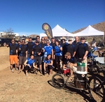
Well it has been a year since I rode on the 10 man corporate team at the 24 HOP. Catalina Brewing offered me a spot on the team
again this year and I jumped at the chance.
Camping:
Ann and I headed out on Wednesday to set up our camp. We had been out earlier in the month and found a spot that was close to the
group but just far enough away to keep us social but still give us some privacy.
Brian showed up that Wednesday afternoon and we discussed the camp layout.
Ann and I went to bed around 11:30 that evening and awoke the next morning to find someone had slipped into the SDMB camp area
and parked right in the middle of things. I though it might be a SDMB member and sat down to eat breakfast until another rig pulled
in.
I jumped up and headed out to see who it was, Texas plates had me thinking they were not part of the group.
I confronted the early arrivals and told them how SDMB had been camping in this same spot for ten years. There would be around
thirty to fifty riders and family showing up over the next couple of days and they were welcome to stay but needed to set up camp so
that everyone could enjoy this communal experience.
The driver didn't say a lot but just jack knifed his rig around and pulled out. The other camper said that he was set up and was
not moving (also from Texas).
Not to be unfriendly, I stuck out my paw and said "Cool, my name is Kelley, welcome to the SDMB suburbs". He replied with
his name, Matt and we made small talk for a few minutes.
When Brian showed up, he reiterated what I had said about the camping area and asked if Matt would mind moving his rig so we could
all share the space, Matt ignored him and from then on it was him and us. Not a good start.
We had eleven folks in camp by Thursday night, a great group of folks to swap lies around the camp fire while enjoying some of the
great beers provided by Catalina Brewing.
Friday brought the mass migration from near and far into 24 hr town. A thick cloud of dust hung in the air as cars, trucks, vans, and
campers pulled in to set up camp.
The Race:
Saturday was the big day, the race starting with a Le Mans type start.
The racers assembled on the road, a half mile from their bikes, ready to scramble for their position in the first lap of the race. The top
teams racking up 23 laps in the 24 hours.
Catalina Brewing set up a table and started filling plastic cups with beer. The table was located just a hundred yards down the road
from the starting line.
With a bang the race started, the leaders charging down the hill in a full out sprint. They flew by us as we stood at our adult aid
station, arms outstretched, with a cup of beer in each hand.
After the initial wave, those participants in the back of the pack came strolling down the hill, where many stopped to take advantage of
our offering.
Soon I would be getting read for my lap.
It had taken some negotiation but I was able to secure the forth lap position.
A little over an hour later I received a text that told me our first rider had completed his lap in an hour and seventeen minutes, Lief had
set the bar high.
Each riders time was being transmitted to my phone via a text which was a real asset for knowing when I needed to be in the timing
tent and what kind of lap was expected of me.
It was really hot for this time of year, February, the temperature in the mid 80's.
I stood in front of the entrance to the timing tent where row after row of racers were lined up. All of them focused intently on the
opening at the far end of the tent where the competitors came roaring to a stop. Each directed to a time keeper as the announcer
broadcast their name and team number over the loud speaker.
The crowd moved forward just a little at each announcement, pushing me toward the front of the group until the announcement of our
team number.
I pushed my way out of the pack, repeatedly hollering "great job Mandy" as I ran up to the table and grabbed the baton from
her. I was seriously impressed with how fast she had completed that lap, although I should not have been, considering how many
times some thin little girl has just kicked my butt on a ride.
She had matched my time from last year.
My goal for this year was to pump out the best time I could, not to just pace someone else, which was my strategy for last year but to
see just what I could do.
That would mean I could not stop for any reason. I had to just keep pedaling.
I punched the button on my camera to start it recording and took off.
I was soon on the back wheel of another rider as we maneuvered through a rocky section of trail right out of the tent.
Within a few seconds I had a rider on my wheel and we paced the lead rider through the jumble of rocks looking for the opportunity to
pass.
Within seconds we hit a short stretch of double track, just before the trail option "Skip the Bitches" and we both
passed.
I took the option. Since I had ridden the skip the bitches section on both of my laps last year and I have never ridden the bitches
section. It didn't seem like a good time to test my skills on a new section of trail for me.
I pressed myself hard and was soon on the back wheel of another rider. He was cranking a mellow pace and I quickly pressed the pass
and passed him.
I passed two more riders in the skip the bitches section.
The skip the bitches dumped me onto a double track line that headed straight out across the desert, a smooth fast section of track that
had me pushing my pace. The chain making a solid sounding "clunk" as I shifted up and stood on the pedals to maximize my
speed and heart rate.
The course runs flat and fast for a mile or so before taking a loop back on itself to turn into a short quick section of double track that
drops across a few washes where I was able to pass a couple of more riders before we hit the corral, which marks the start of a
section of single track that winds its way through a dense mix of prickly pear and cholla cactus.
The trail was narrow with lots of opportunity for mayhem and few opportunities for passing as I soon found myself on the wheel of
another racer.
I scanned the trail as far ahead as I could, looking for one of the short passing lanes.
Within a few seconds I was shouting "On you Left" as I jumped out of the saddle and hammered down on the pedals. My bike
wobbled back and forth under me as I pushed my heart rate to it's max and pumped for all I was worth to make the pass in the
short break before the trail re-merged into a single track.
Gasping for air, I settled back into my cadence.
I passed a couple of more riders and had one pass me.
I was pressing myself hard and wondered how long I could keep up this pace, hoping that I would come up on someone with a pace
that was not too far off mine so I could pace them for a while and try to recover. No such luck.
I soon had a small group behind me, I could tell there was more then one rider but had no idea how many. I slacked off as I entered a
passing section to let them pass. Three riders passed before the track merged to a single line. I slipped in behind the third rider and
heard someone behind me let out an exclamation of disappointment as I took the line.
Since I too was looking for the best time I could get, I was not stopping!
A few seconds later I was on the back wheel of another rider and when the break opened up I charged forward. It was a short break
and as the trail again merged into a single track I felt the pain of a needle stab into my little toe, I had clipped a prickly pear
cactus.
I could not stop to fish around in my shoe and find the sticker. My toe pulled back as I cranked down on the pedal and I tried to probe
the side of my shoe, hoping to press against the little spike and push it out or break it off, with no luck.
I was not quite half way through the seventeen mile loop but knew I would blow my time if I stopped so with my toe bumping up
against the little spike on every turn of the crank, I pushed on.
The trail broke onto a double track with a short climb. There were a half dozen of us hammering up the hill with one passing me and
me passing yet another rider.
I set up my pace along this stretch of double track and had another Lycra clad biker pass while I passed another three or four riders on
the short stretch of double track.
Back to the single track, my mind was doubting my ability to maintain this pace for much longer. I felt like I was gasping for air
constantly.
The track broke over a hill and dropped down through a small group of supporters shouting out encouragement as I passed the
whiskey tree.
The trail took a slight downward turn here, as I swooped through turn after turn. This was a place where I could maintain speed and
recover some if I could keep myself on course, maintaining a tight inside line, cussing myself every time my finger touched the break
lever.
Everything I had ever learned about mountain biking came into play as I concentrated on leaning my bike into the turns while weighting
the outside pedal and pointing my inside knee in the direction I wanted to go.
I tried to squeeze every inch of momentum out of the line as I slammed through dips and washes, throwing my weight back and forth
through anything that even looked like I could pump it.
All to soon the trail dumped me on a short double track as it turned to offer up the final few miles of climbing. The section was not
steep, just a low grade climb that was broken up with short sections of near flat.
My strategy did not change, put it all out there, I did not want to end this lap with anything in the tank.
I was passed by a few riders on the climb but passed more than passed me.
The interesting thing on this kind of race is there are so many different styles of riding. Many styles dictated by whether you are on a
team or if you are a solo rider, or a roadie on a mountain bike. Single speed riders seem to take the climb out of the saddle, which is
where I find myself on a lot of the climb. I find a single gear that seems to work for me, then stand up when it gets steep, and sit
when the climb breaks. Lots of the geared riders use a wider range of gears, focused more on spinning then power.
As I approached the top of the climb, the trail offered up a few quick sprints and short downhill runs before breaking over the top of
the ridge.
Just as I came up on the break, there was a female rider in front of me. The tread turns very rocky through here and as I came up on
her, she dumped it, falling off her bike. I pulled up and asked if she was hurt, other than her pride. She replied that she was fine,
exclaiming she had fallen at the same location on her last lap. (I am sorry but all I could think was "Roadie")
I rumbled on through and headed down the final descent into 24 hrs town.
The track is as fast as it gets on this course. There are lots of places to eat it and the tread is well abused with lots of breaking bumps
before hard turns and some of the short deep wash crossings.
I did my best to carve a line that missed the concentration of breaking bumps but still optimized the descent.
The final feature, the rock drop; The course offers one opportunity to do the crowd pleaser, a large granite rock descent out of a huge
rocky feature or do a ride around and scream past all the onlookers.
I have to admit that I love the rock drop. It is a real thrill to skid down the face of that boulder with a big crowd hooting and
hollering.
It did not disappoint. Though later that day one of the riders that was camped with our group did a header and had to be taken out in
an ambulance. He ended up with some fracturing of his spinal column. Later he was released and they headed home.
I finished my run to the timing tent, pulling up to the controller just as another rider came slamming into me.
The controller stuck her hand in his chest as I walked my bike over to check in.
My time was ten minutes better than last year, at one hour and twenty three minutes.
The team overall did better than last year, we had a few new riders and every one was really cranking out good times.
I only did one lap this year and I spent a few hours volunteering as a crossing guard on Sunday.
The Brown Mountain ride in Tucson Mountain Park.
The mountain bikers in Tucson put on a ride event every Christmas which they call the Eightish Days of Christmas. Each day from Christmas through New Years day there is a different ride scheduled with different
ride leaders leading the ride.
My first ride of the Eightish Days was the Brown Mountain ride. This is not a ride for the faint of heart.
The ride had been posted with an optional start for those who wanted just the core ride, Brown Mountain.
The group for the whole ride, which is what I opted for, was to meet at area G5. There are pullouts all along the roads in Tucson Mountain park and each has a number associated with it. Those that wanted to do a
shorter ride were going to meet us at area K19.
The group meet up at 3:00 and we were soon turning cranks on the desert trails.
The trip to Brown Mountain was across the desert on a series of interconnected trails and old jeep roads. The trails were in need of some love, the cats claw and prickly pear were encroaching hard into most of the
lines.
The trails were rough, lots of loose scrabble and grit. The line a gritty fast track that dropped through wash after wash. Each one presenting another technical challenge, ranging from rough chunky drops to a steep
rock and rubble drop into the bottom of a sandy wash that would be followed by a loose rock and rubble climb back out. It was a real challenge to maintain speed and the right gearing to hammer those punch ups
out of the wash.
We blasted across the desert, the ride leader setting a fast pace but regrouping at the numerous trail junctions.
The ride over to Brown Mountain linked together a half dozen trails, some jeep and power line access roads, some fence line roads, and some single track that wandered through the saguaro.
If there were any riders that were going to do just the eight mile loop over the top of Brown Mountain, they were going to meet us at the K19 parking area; there were no riders waiting for us.
The trail from the parking area was a single track that dropped through a shallow wash before turning to parallel the mountain on the North side.
The trail climbed a hundred and fifty feet over the next mile or so at a three percent grade. Then dropped back down, losing a hundred feet of that gain over a half mile before the real climb started.
The track climbing at an eleven percent grade through a couple of switchbacks, for a quarter mile or so, to gain the ridge line.
The trail turning back on itself to continue to climb at the same rate. The tread a gravel mix with rugged outcroppings. A very challenging climb with a few places that pulled me from the saddle to push my bike up
and over.
The line to the top of the first of three intense climbs contained a couple of hard turns and one impossible switchback. The switchback presenting a very tight turn while continuing to climb in the rugged rock and
rubble tread.
The line moved from the north to south side of the ridge, then back again before a short descent through a couple more switchbacks.
The descent a rumble line punctuated with grit and loose rock.
The trail dropped into a swale between two peaks on the ridge line. The area covered in cholla, ocotillo, and desert brush with some large saguaro.
We took a short break to regroup before taking on the next climb, another third of a mile with a pitch in the neighborhood of fourteen percent.
The climb was intense with moderate exposure and quite a bit of hike a bike. One of those lines where you could get on and ride for fifty feet, then have to get off and bounce the wheels up and over a series of
rocky steps before remounting. Some of the riders tried to crank out every bit of the trail, others just gave up after the first couple of rugged outcroppings and pushed their bikes to the top.
The one switchback on the climb had a run out, kind of like one of those truck run away spots you see on the highway coming down a big hill. The run out was about six feet long and a good spot to remount your
bike and attack the next fifty feet before being pulled off again to push up and over the rocks.
This grade on a smooth track would be almost unsustainable and on this tread the little four to six inch lifts felt like they were a foot.
Cranking up the track was a balancing act between keeping the front wheel on the ground and maintaining enough weight on the back wheel to keep it from slipping, it was all I could do to bounce up and over a
little four inch lift.
The top of the ridge flattened out and provided some great views of the surrounding desert. The major peaks of the Tucson mountain park off to the north and the broad expanse of the desert stretching out, with
some water clarification or tailings ponds glimmering far off in the distance to the south.
We started cranking again, across the top of the ridge. The trail rolling down the top of the ridge for a short ways before taking a jog to drop over the edge on the south side and into a moderate pull up to the next
peak.
We regrouped again for another short break, with the rugged ridge line laid out in front of us to the east.
The trail descends to cross back and forth through a half dozen switchbacks. The tread a rubble rutted line where I was able to negotiate most of the switchbacks.
The last turn drops the trail down through a section of rock steps, a jarring rock and rubble line that again shifts south and runs across the side of the mountain until it levels and flows back on to the top of the
ridge.
The ridge top trail meanders back and forth, a well developed track that incorporates a gravel tread with multiple small rocky outcroppings.
The line drops off the end of the ridge to cross back and forth a couple of times, the tread a gritty rumbling line that I was able to dab through the first two switchbacks but the third pulled me from my bike to turn
and walk my bike down through the drop and rubble.
The rider in front of me stopped at the switchback. He stood over his bike looking down through the switchback, picking out a line. Then he hopped up on the pedals and dropped into the turn, hugging the line high
on the inside he was able to bounce across the tops of a half dozen large boulders before dropping back into the trail and out of sight.
The descent is a very technical line with lots of big rock steps that are punctuated with plenty of rubble. There are a couple more switchbacks, that are more of a wide turn, but the tread is very rough.
The line drops at a moderate rate before leveling off but the tread remains extremely rough so the track becomes a lot more challenging.
The trail makes a 180 turn at a trail junction and heads back around the base of the mountain to where we had started our trip up and over Brown Mountain.
We rode back to cross over Kenny Rd and head back to the G5 parking area. The return line was the same as we had ridden out on.
We did reach a point where the ride leader decided to take a different line back. We followed a power line access road down toward the main road before turning again to parallel the main road.
The trail was not any better than the one we had ridden out on, lots of cactus and pokie bushes hanging into the line. There were plenty of spots where I had to make a choice between clipping a prickly pear or the
cats claw and when I got back my legs bleeding from the cat claw scratches.
Sedona's Slim Shady
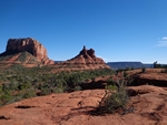
It was a warm day in the late fall sun.
I stopped into a local bike shop to pick up a trail map. The sales guy was very friendly and knowledgeable on the local trails. He pointed out that there was a trail head for the Slim Shady trail right across the street. He pointed out some options for a ride, and I decided to do an out and back using the Slim Shady and the Templeton trail with a loop around the Baldwin trail before heading back.
After searching up and down the street I found the trail head. It was located behind an apartment building.
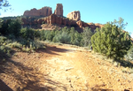
The Slim Shady starts off running across a field then starts to climb as the field gives way to juniper and pine. The tread became a mix of red dirt with rocky rubble and slabs of sandstone or slick rock.
The line drops into a wash as it climbs, presenting a narrow line with some challenging punch up sections until it reaches the trail junction with the Made In The Shade trail.
The Made In The Shade trail is a loop trail that climbs up through more then a dozen switchbacks on a rough rubble line. It then turns and descends through more rubble and multiple switchbacks to rejoin the Slim Shady trail. I didn't find anything to compel me to ride that loop again.
The Slim Shady trail continues from the junction, dropping through a number of small washes, providing quick climb challenges at each crossing. I found myself off my bike on almost all of these to push a few feet. I think after a few rides on this trail I would be able to clear these short burst climbs, it is mostly a matter of knowing they are coming and being in the right gear combination. I am sure that like so many trails, familiarity with the line would make a big difference.
The trail rambles across the hillside with plenty of little rocky challenges and a few large red rock plateaus that provide great views of the surrounding rock features.
I lost the track on the first of the large slick rock plateaus, riding across the rock looking for the trail and being distracted by the views. It is easy to get distracted and wander around a bit, the Slim Shady trail had just passed across the edge where I had first gained the slick rock ledge.
I back tracked across the rocks and picked up the trail, climbing just a bit before starting a run down the top of a ridge. The line presents lots of rocky options to drop across, interspersed with lots of rumbling action, on a fast paced descent.
The trail rumbles past a trail junction as it turns away from the ridge and starts a quick paced descent. The tread made up of lots of rocky sections. The layout is such that you want to keep an eye out for the best lines, there are a number of short fast blasts across flat rocks that have been laid out on one side or the other of the trail.
The trail drops into a wash, the tread mostly a bedrock line down the bottom of the wash.
Slime Shady Video
After a couple minutes of a screaming fast fun rock and rumble ride the track takes a turn out of the big wash and moves into a low grade climb as the tread turns back into a red dirt and rock.
I found myself jumping up and cranking it hard in mid range gears as the line crossed the hillside toward the next trail feature.
The line was not easy to spot as the trail gave up the dusty tread and rolled up onto a large slick rock. I wandered again across the top of the rock, a large drop on the other end turned me around and I ended up dropping down the steep right where the trail met the rock. I later found that there was a middle line which is the best option in my opinion.
The trail continues to roll up and down across the hillside, lots of rock and rumble with some very nice sections of slick rock riding before turning to drop into a very fast swooping section of trail.
The line runs fast down a wash where the trail provides a line that swoops high on a series of banked corners as it blasts you through a narrow gully. My only fear was flashing around a corner and slamming into someone riding up the trail. The corners were very tight but so much fun.
A quick rise up across some rocky features and the Slim Shady ends at the junction of the Templeton trail.
I turned to follow the Templeton trail. A red dirt chunky line that descends through a wash, then provides a few minutes of mid range gear climbing.
The track runs from dirt to slick rock ledges, at first it crosses some small ledges, then makes a stronger transition onto a solid rock ledge. I missed the subtle line shift at one location and had to dismount to push my bike up some rock steps and back onto the line.
The trail levels out when it gains the rock ledges, the line running level as it travels in and out following the profile of the mountain.
The cathedral rock spire appears and disappears as the line flows around the rocky ridges.
The track supplies some moderately technical rock drops in a few places, I didn't have any trouble with any on the way out but did get caught a couple of times on the return, mostly just missing the best line for bouncing up onto a ledge.
After about five minutes of cranking along at a mellow pace the trail reaches the Cathedral Rock trail junction and the trail starts to descend on a much more technical line.
When I looked over the map, I looked at each trail junction and noted all as being "Blue", as in rating them green, blue, black diamond and double black. So I was a bit surprised as the technical factor went from hum to whoohoo as I started to descend across the slick rock.
On my return trip I did find better lines to climb through this section, also note; there were a lot of people in this section of trail, all up exploring the Cathedral Rock.
The line drops a little then levels back out, narrowing up in some spots as it follows the contours around a couple more ridges before the real pucker factor kicks in.
Double Diamond Video
The trail starts to rumble as the line narrows down considerably. I notice a wirey rail off to my right for a short section. The chunky line rumbles around the corner to present a series of four to five ledges stacked one on top of the other, none more then a foot wide. I dropped down to the second from the bottom and rolled along the narrow ledge which terminated in a series of rocky drops.
This was the start to the double black diamond section that I had failed to notice when I was looking at the map earlier. Later when reviewing the map I noticed that there were many trails with sections that were rated black or double black. I would not let that keep me from riding the trail, these sections can easily be walked.
The trail along here just a couple feet wide, the ledge a big drop with big penalty for a mistake. The tread was hard pack with rocky slabs, just a little chunky, but still big penalty for a mistake.
The line was near flat as it crossed this section that lead into a steep rocky step descent through a couple of switchbacks.
The trail drops steeply over a dozen large rocks into a wide switchback, to turn and narrow back down as it traverses the rock hillside. I missed the line and lost the descent here as there was what looked like a line going on around the hillside but turned out to be the top of a pinnacle.
I re-mounted my bike at the bottom of the switchback to roll across the rocky face to the next switchback, a very short section. Again I got off my bike, this time to flip it around and point it down the trail, the switchback was so sharp.
The trail continues to descend with lots of rocky drops and more exposure.
The line traverses the hillside on the descent to another very sharp switchback. This one has a step right at the switchback which again pulled me from my bike to flip the bike around and roll on down the trail to the bottom of hill. The trail becoming more and more overgrown as it descends to the creek below.
After making the descent, the trail makes a wide turn to follow Oak Creek downstream. Cruising along through the brushy undergrowth next to the stream, it meandering along until it crests a rocky knoll and diverges into several lines.
It was a little hard to discern which line was the trail as there were trails running all over.
There were a dozen or more people wandering around and at first glance I thought I was going to have to ford the creek.
I pulled the map from my pack and could not tell if I needed to cross the creek when a guy carrying a bike came over a large pile of boulders.
I grabbed my bike and started picking my way up through the boulders to find the single track. As I move up through the boulders, it was obvious that this was the trail.
From the top of the jumble of boulders the trail ran across the hillside, dropping back down to the bank of the stream. The tread was a mix of dirt and boulders.
The trail again diverged into multiple lines as the terrain flattened out. The tread became a sandy dusty track.
Within a couple of minutes I came upon the Baldwin trail junction.
The Baldwin trail is a loop trail that is about two miles long. The trail is rated as a blue trail with a short section of black diamond.
I rode the loop in a counter clockwise direction, it started with a hardpack line that quickly narrowed and climbed up into some rocks. A narrow set of rocky steps that drug me from my saddle to carry my bike.
The short climb ends on top of some slick rock where the trail widens out to continues to climb on rock and dirt tread.
The wide line of dirt and rocky steps heads west to the primary trail head.
From the trail head the trail heads south across the west side of the rocky outcropping. The tread, much like it has been, a mix of hard pack and rubble with sections of sandstone.
The trail seems to be following a power line along here. The line moving up and down over ridge after ridge and presenting challenges on both the climb and descent. The climb up a steep slick rock with numerous little rocky step ups and descending down a rubble strewn path to cross a wash or dry water course to turn and climb again.
The trail comes to an intersection with another trail, the Baldwin trail turning toward the hills and narrowing as it climbs through the pinion and ocatillo.
The trail ascends to provide some fine views of the surrounding area.
The trail follows the contour of the hillside more closely then the utility trail that was following the power lines. It provides a much better ride, with lots more slick rock.
There are a number of very stiff climbs with large rocky steps that drug me off my bike to carry it ten feet. There was a one hundred yard stretch where I must have been off my bike a half dozen times.
The trail provided plenty of fun fast descents over the slick rock and rocky steps. My drop seat like a pogo stick, popping up and down as I would hit a steep rock descent. It seemed like every descent caused me to shift my weight back over the rear wheel as I dropped through a series of rocky steps. There were many places where the descent gave me pause but only one that caused me to get off my bike and pick my way down the slope.
The trail dropped into a narrow ditch, the ground swelling on either side. A moment later the ditch spilled out onto the top of a narrow ridge, the ground dropping away on both sides. The tread was made up of large slabs of slick rock, providing a rough and rumbling track. The ridge narrowed more as the rocky slabs turned into chunks of rocks with narrow gaps between them, a narrow ledge that dropped off sharply on both sides. The rocky rumbling path narrowing to less than a foot. The narrow exit rumbles down a row of rocks and drops you at the top of a steep gritty descent. There is a good fifteen to twenty feet of controlled skidding before you can regain traction.
This is where I dismounted and picked my way down the hillside to a point where I felt comfortable remounting and skidding on down the rest of the descent.
The trail has brought me two thirds of the way around the mountain at this point and starts a moderate descent along the edge of a wash.
It is a nice chunk of single track that runs high on the bank of the wash, supported by rocks and pinion. The line drops to cross the wash, then quickly crosses back and gains the high ground again.
The tread mostly dirt with a few quick technical rocky spots.
A few minutes of riding and the trail deposited me back at the Templeton trail.
I have a pretty good idea of what is ahead of me on the return trip.
The trail climbs up over large boulders and rocks to drop over an outcropping and back to the creek.
A short run up the creek and the line climbs up the very technical double diamond section of switchbacks.
I did the hike a bike up the switchbacks, but did ride the narrow trail as it cut it's way around the gorge, until I was again pulled from the saddle to push up the last bit of the double diamond track.
Back on the wide slick rock ledges, I took it easy and looked for the most opportune path for transitioning up from one ledge to the next until I reached the ledge that the main trail traversed for the next couple of miles.
The slick rock run back on the Templeton trail was loads of fun with just a few quick technical spots, most of which I missed and had to either dab or get off and push myself over.
I had been thinking about the Slim Shady trail on the ride back, looking forward to the challenging climb up the rocky gorge I had come down.
I looked forward to challenging myself on some of the short rocky sections where there was an option of riding a dirt line or rumbling over some well placed stones.
The climb did not disappoint. I was able to clear most everything but did have to stop a few times to let my respiration and heart beat return to a reasonable rate.
There were a number of sections that required a mid range gear to maintain enough momentum to climb up and over.
I enjoyed the ride immensely and later in the week rode the Slim Shady down to Templeton, but instead of following Templeton I continued on straight ahead, picking up a couple of other short sections of different trails that looped around to the Llama trail for a nice couple of hours of riding.
Phil's World Day 2
Since I did not get to complete my Phil's World ride on Friday, I decided to take another shot on Saturday.
On Friday there were maybe five cars parked along the road and in the parking lot, today the lot was packed with cars and they were parked all up and down the rode. There must have been 30-40 cars.
I again started by riding up the Kokopelli trail and went screaming down the Coco Race trail and back to the junction with the Lemon Head trail. I decided here that I would take the connector trail to gain access to Bob's loop and onto Abajo again.
I rode out to the Stinky Spring Loop junction and decided to ride that instead of repeating the Ledges trail.
Stinky Spring starts with a fast paced hardpack line that heads down through some wide shallow draws to offer up a quick climb up to a point where there is a great view that takes in the surrounding mesa's and valleys with the town of Cortez far off in the distance.
The trail runs for a quick sprint down the top of a ridge before dropping into a series of whoops created as the line swoops back and forth through a narrow wash. A fast track with some nice banked turns.
Just as fast as the whoops started, they come to an end with some semi technical rocky features.
The trail presents some rocky steps with the line running over a short section of rock ledge before screaming down through a section of pinion pine to cross another wash and start a moderately technical climb.
After some more fast hard pack, accented with a few rocky rumble spots, the line crosses the mesa to trace the edge and provide lots of rumble riding.
This trail should have been named the Ledges because of this section. A long run that follows along the eastern and southern edge of a high mesa. The views are great. The track runs along the top of a rocky ledge with lots of small steps and large flat stone areas. Some real fun and beautiful rock riding with outstanding views.

After about four miles the trail leaves the rocky ledges. The line takes a turn down a rocky run that is an advanced line.
The trail descends into a wide wash. The track is a moderate decent that rumbles through a rocky section where picking the right line is key to the success of clearing the descent. This short section has a high potential for carnage.
The trail continues a low grade descent to cross a wash then climbs at a steady rate back to the main trail system.
The Stinky Springs trail merges with the Rib Cage trail and after some short rumble sections across some exposed sandstone the line drops dramatically into a deep wash.
The trail drops down one side of the wash on a very steep pitch to swoop through a very short radius and launch you back up the other side.
The key to riding the Rib Cage is; don't use your breaks. The momentum from the descent will carry you up the other side.
As the momentum carries you out of the small gully, the line turns ninety degrees and drops back into the gully.
It was very hard for me to not use my breaks, I would catch myself squeezing down on the lever, as I shot up the side of the narrow ravine.
The trail runs fast through a series of swells, the line rolling up and down through the sage and juniper until it makes a fast turn and drops back into the deep ravine.
The climb out requires a little effort and the trail continues to ascend at a low grade to peak out and drop into another fast paced rolling line.
The trail runs out across the open expanse at a very fast pace, with lots of rolling terrain and a few kicker options on ether side of the trail.
A junction appears and there are a couple of options. The trail to the right has a sign that says "More Ribs just don't eat it". The trail to the left continues on to the DRB ESB trail.
I chose to take the More Ribs trail. The trail climbed up a short ways to reach the trail junction for Lemon Head and the connector to Bobs Loop. Now I see why the connector is here.
I rode the loop again, down Bobs Loop and Abajo to re-ride The Rib Cage.
Back again at the More Ribs junction, I took the DRB ESB trail.
The DRB ESB trail dropped down one side of a small ravine at a nice fast pace to drop through the ravine and climb up the other side, back to the top of the first ridge where the Bike and Board trail runs next to the DRB ESB trail.
I continued on the DRB ESB trail. The line dropping at a nice fast pace through the small juniper, bumping over some rumble as it crossed some shallow drainage's.
Swooping down the hillside until I came around a corner to find a young lady standing along side the trail looking at a map. There was a junction just around the next turn with the Two More Loops trail.
I rolled by as the line dropped quickly into a swale, the tread a dark color from an old burn.
The track followed the depression down between a large black mound that supported the white ghost of a juniper tree and a ridge of large jumbled stone slabs.
The trail offering up some nice flat stone in the line here, just before the junction with Two More Loops
I took the quick left onto the Two More Loops as the trail followed the ridge around and dropped into a rocky ravine.
The ravine presented a short technical section of rocky steps, the line was very straight forward as each rocky steep seemed to lead right into the next. The trail dropping through the rocky ride and back onto hard pack quickly. It looked much more difficult than it was.
The Two More Loops trail turned to climb a bit then back on itself to descend, following a very serpentine line that turned and twisted up and down the hillside until it finally exited to cross the primary gravel road.
The exit provided a couple of alternatives. You could ride the road back to the parking area or drop down onto the Trust Loop, which offered still more riding or a short cut to finish the ride back to the parking area on single track. I finished on the single track and decided not to ride the Trust and Hippy House Loops.
It has been quite a few years since I last rode in Cortez Colorado.
I was excited to again ride on the Phil's World Trails system.
They have improved the parking and added some porta-potty's.
I started off on the Kokopelli Bike and Board trail, it leads up to a junction with Coco Race and nearby DRB ESB trails.
The Bike and Board trail climbs at a moderately easy rate, with a number of winding turns and a couple of short flat to glide sections. As the trail nears the end it passes through a sections that contains large flat stones, three to five feet in diameter. A section that looks like it could be developed into a great skills area for rock riding.
The standard way for riding this trail system is to take the Coco Race trail from here, if you were to make a short loop, you could turn and head back down via DRB ESB and pick up the 2 More Loop trail.
Coco Race is a great fast downward slope run, lots of swooping turns and a few kickers. Just a few turns into the run there is an option that forks right to roll a big swell that has a root drop just after cresting the top, a good option for those looking for just a little more.
I blasted down the trail through the juniper and pinyon until the line broke into the open, an area of low brush and a final feature where the trail crosses a deep wash. This needs to be hit at full speed so that your momentum will carry you up the other side.
The trail turns into a low gear climb in an instant, with the front of my bike dancing back and forth in a couple of places while I climbed through the rock and root sections as the trail approached the base of the small plateau.
The trail follows just below the rocky crest of the mesa, winding around under the ledges. The rocky structures just a few feet away, pillars formed through wind and water erosion, jutting up and overhead.
Another trail junction, this one with the Bob's Loop connector and the Lemon Head trail appeared as the line leveled off and wound up into a wide saddle between the mesas.
I don't know why anyone would bypass the Lemon Head and other trails that follow and take the connector, but yet there it is. I would find out later that this and another short connector trail are here for those wishing to do multiple loops of the Rib Cage section.
Lemon Head starts off with a quick descent down the western side of the mesa, the line running out and parallel to the mesa until it turns back on itself to climb and gain the top.
The Lemon Head runs along the top of the mesa, clinging to the east edge and offering some rocky riding.
The line takes a turn to the west and blasts down through the Juniper. Full green bushy trees and lots of white bleached out remains of fallen and dead trees line the trail.
The line slowly meanders around and ends up headed north and turns into a trail called Maze.
The Maze starts a series of switchback that runs down through a shallow wash before turning to a low grade climb up through some mild rocky stuff.
The tread through here is mostly hard pack, an adobe color that feels very solid.
The next junction offers an option to turn north and take in The Elbow, a solid ride that takes in some rocky ledge riding and provides a couple of short technical challenges.
The Elbow is a loop that deposits you on Bobs Loop, which isn't a loop at all.
The short straight line that is Bobs Loop, is a fast hard pack run with a couple of fast drops through a couple of washes.
The trail hits a junction with a short connector that will take you to the Here For More line that provides an exit line from the system or continue on to the Abajo trail.
Abajo climbs a little at first then turns to run back out onto some more rocky ledges and some great views for photo opps.
The trail continues along the edge with some easy rock riding for a short ways then crosses over the top of the mesa to ride a few more sandstone sections before the next junction with the Ledges Loop.
The Ledges Loop is about a three mile loop that never seems to provide a lot of ledge riding. The trail starts with some fast hard pack across the top of the mesa to the edge where there are a few short bumps over some stones before making a run through the Pinion again with lots of rough and rumbling tread.
The line turns into a downhill stretch at Woodpecker Ridge to rumble down through a couple of switchbacks on lose tread.
A short climb and the line returns to more of the hard pack with an occasional break across some sandstone.
As the trail approaches the point where it will turn back, about a mile and a half in, the line starts a moderate climb up a slick rock sections. This may be where the ledges name comes from.
The climb terminates in an open area, the trees here lost to a fire, with all that remains being chard black stalks where there were once trees.
The trail makes a turn back on itself and starts heading south.
The line drops into the trees again then starts a strong climb, the strongest climb in the system.
The track is a narrow line that climbs at a steady rate, driving me into a low gear range. It is just to long for me to power my way up in the mid range I have been riding in.
Just before the trail breaks back on to the top of the mesa, it presents some rocky steps to negotiate (really requiring a mid range gearing to power up through).
As I broke up over the rocky steps, I could see a front moving rapidly toward me.
The day had been cool, dark clouds passing over the surrounding hills where it was snowing. The weather report had predicted a chance of showers.
The prediction looked like it was going to turn into reality, as I looked out across the valley below me I could see a front quickly approaching.
Within seconds; hail started to hit me.
I moved over under a couple of Juniper, hoping they would help shield me from the hail. It didn't take me long to come to a wet realization that the trees were almost no use at all as protection so I pulled my rain coat from my pack.
It was hailing hard, melting fast and the tread turned to muck in just a couple of minutes.
A brown fog floated above the wheel as I rolled along. My tires packed with mud, the frame scraping the muck off as the wheels turned.
The track felt like grease with both my front and back wheels side slipping as I continued to crank.
The line moved into a rocky sections where I worked my wheels over the rocks, trying to bounce and hop to knock the mud and muck from my wheels with very poor results.
I stopped for a second and tried to walk my bike but within a few steps I realized that was not working either.
Dragging my shoe across the platform pedal to scrape the thick layer of mud from the bottom, I continued to ride slowly down the trail. I was at least five miles from the trail head.
I was afraid to try shifting gears. I locked my fork out and had set my dropper seat all the way down in an effort to keep the muck off the shaft.
The line the trail was taking, crossed a double track. I decided to turn onto the double track in an effort to minimize the impact I was having on the single track tread.
Checking my map I could see the double track was going to take me down the length of the plateau but I could not spot a double track to take me all the way back.
The rain and hail passed, the tread recovered quickly and as I reached the end of the plateau I was able to pick up the Here For More trail.
I spent a lot of time standing and cranking out the climbs. Stuck in the same gear with my seat down, still unsure how damaging it might be to shift into another gear with the muck now starting to harden onto my bike. It was like riding a single speed trials bike.
The DRB ESB trail and the Kokopelli Bike and Board trails pass by each other at one point. Since I was unsure of the DRB ESB trail, I chose to exit via the Kokopelli trail.
I threw my bike over the tail gate on my truck, stripped my outer shorts off and headed toward town, looking for a car wash all the way.
I spent five dollars at the car wash to rinse the mud off my bike and shoes.
Riding at Castle Rock State Park.
While traveling through Idaho I made a stop at the City of Rocks national reserve. I was looking for a place to ride.
The US government had gone into a shutdown so the reserve was closed to access, but after talking to a state park ranger, the City of Rocks is jointly operated by the
state and federal government, I was told that there were a few trails open.
I decided to ride a network of trails at the Castle Rock State Park, just a few miles away.
Castle Rock State Park attracts rock climbers from all over the world and there is a network of trails that surrounds the rock structures.
I parked in the lower parking lot and rode up the gravel road to Castle Rock. The silhouette of the rock does resemble a castle, with sharp straight spires rising high above
the surrounding landscape.
I started my ride by heading out on a looping trail called The Backyard Boulder trail.
The trail runs through a small wash before turning to start a mellow climb that circles Castle Rock.
A couple of short rocky sections were presented right away, then the trail offers a turn to run out to the outlying rock protuberances; 3-Pool Boulders and the
Backyard Boulder.
There is a cut off trail, a double track that continues running next to Castle Rock but I did not ride it.
The outliers were very interesting, jutting up out of the ground, smooth granite rocks that just enticed one to explore.
After passing the Backyard Boulders the single track turns onto a rough and rumble double track that runs down to the back side of Castle Rock.
There is another junction here with the Backyard Boulder cut off.
The trail takes a turn toward the north and descends down a fast double track to cross another small wash, a short wooden bridge is off to one side but crossing the wash
is straight forward.
The trail intersects another line on the other side of the wash, descending to another group of rocks called Tiny Town. Tiny Town has some pictographs that I was never
able to find, or just not able to distinguish.
I made my way back up to the junction after visiting Tiny Town and continued north on the double track trail.
A short ways down the trail there was a trail junction with the Stines Creek trail and a sign that indicated the trail high point was a mile and a quarter up that
trail.
My first intent was just to ride the lower trails, skipping the climb to the high point.
I continued to ride north on the double track, checking the map at every junction for single track open to bikes.
One junction offered a single track that was probably a quarter mile in length so I followed it to make a loop that connected to a double track, which was part of the
double track I was already on.
Continuing north up the double track I passed close to Shark Rock, a narrow monolith jutting straight up out of the ground.
The double track trail presented more moderate grade so I continued grinding my way uphill, through a cattle gate and past more granite outcroppings.
The whole time I could not help thinking that this was not the line I wanted to ride down, a wide double track that was mostly featureless.
After a half mile or so I came to a junction where the Ewards Home Site was downhill and off to the East, and the main trail continued off to the West. After consulting the
map (an aerial photo with dotted lines drawn on it) I chose to continue on.
The map showed the trail circling a large group of granite features.
I mistakenly thought that the trail would level off and maybe even present some downhill running on the backside of the monolithic grouping. I was wrong.
The grade increased and I was forced to stop a couple of times to catch my breath in the thin air.
The line was still a double track but one that was very old and it looked like it had not seen four wheels in a long time.
The tread was beat, a chewed up line that had seen the hooves of many horses.
The trail passed by a number of granite structures but I was never offered an opportunity to ride on any rock formations.
Twenty minutes of cranking up hill in my bottom two gears finally produced a sign that read, High Point 6720 Feet.
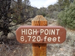
The trail immediately started to descend. A moderate descent at first as it continued in the same westerly direction.
I was ready for some fast downhill running and the grade was starting to accommodate me as the trail turned to single track and passed by more rock structures.
The line started to flow as it passed through some beautiful aspen and other deciduous trees in full fall colors.
The trail was punctuated with some rock and rumble as it started to scream.
I almost lost the trail as I blasted past a turn. Lucky for me because I would have ended up riding off on the Fin Rock trail had I not noticed the sign.
The descent was a good one, the single track a little rough from the horses but still lots of fun as the line weaved back and forth.
I could not help thinking that if a few mountain bikers were cut lose on this line the fun factor could be increased significantly by a few berms on the corners.
A fast blast down the trail had me back to the double track I had ridden earlier and the sign that had indicated the high point was just a mile and a quarter up the
hill.
I retraced my track and rode back out on the Backyard Boulder trail, a nice fast paced line. I made a loop around each of the rock formations as I cruised back to the
gravel.
If you are in the area and just need to ride, this trail will suffice.
While camping in the area I was talking to the camp host and was told that they had a paid trail crew but government cuts had ended that this year. This could be seen as
an opportunity for mountain bikers to step up and develop some of these trails. This trail could be developed into a great ride by taking in some of the rock formations and
finding a few granite rock roll options.
Ride Report Archive Pacific North West 2013
Tuesday 05/21/2013
The Gran Fondo of Growlers Gulch.
Friday 06/14/2013
GITs (Guide In Training) ride the Heckletooth Trail.
Thursday 07/18/2013
A few new trails.
Tuesday 08/20/2013
Huffman trail and Siouxon Butte.
Monday 09/09/2013
On 9/4/2013 4:22 PM, Post Canyon Tom wrote:
Ride Report Archive Cali 2013
Tuesday 04/02/2013
There's Gold in them thar Hills
Saturday 04/13/2013
The Johnson Ridge - Irish Open Spaces
Tuesday 04/30/2013
Four days of the Sea Otter Classic
Ride Report Archive Arizona Spring 2013
Saturday 01/12/2013
The Robles Trail System Tucson Az
Monday 01/28/2013
Cat Scratch Fever...the Arizona Trail from Redington Rd to La Milagosa
Monday 02/18/2013
Millie
Monday 02/25/2013
24 Hours in Old Pueblo
Tuesday 03/19/2013
Gold Canyon
Ride Report Archive Dec 2012
Sunday 12/16/2012
Riding Old Fort Ord trails.
Saturday 12/08/2012
Paradise Royal
Sunday 10/14/2012
Mountain Biking 101
Ride Report Archive Aug 2012
Friday 08/31/2012
Coldwater Trail #211.
Friday 08/17/2012
Deschutes River trail - Bend
Monday 08/06/2012
Ape Canyon Trail - Gifford Pinchot
Ride Report Archive July 2012
Thursday 07/26/2012
Sandy Ridge.
Monday 07/16/2012
Thunder Lightning and Brambles.
Tuesday 07/10/2012
McKenzie River Trail with the PhattyPuss Crew.
Ride Report Archive June 2012
Wednesday 06/27/2012
Mud Muck and Horseshit!
Saturday 06/23/2012
Solo Growlers Gultch.
Wednesday 06/20/2012
Growlers Gultch with Bob.
Tuesday 06/12/2012
Spokane's Beacon Hill.
Saturday 06/02/2012
24 Hours Round the Clock Race Spokane
Ride Report Archive May 2012
Tuesday 05/22/2012
Growlers Gulch 5k, How Hard Could It Be?
Saturday 05/12/2012
The Hog Trail.
Monday 05/07/2012
New Trails at Scout Lake
Ride Report Archive April 2012
Sunday 04/29/2012
Training for the Growlers 5k.
Thursday 04/19/2012
Spanky!
Thursday 04/12/2012
Barbie Camp.
Ride Report Archive March 2012
Friday 03/30/2012
Yesterday was pretty dry for this time of year.
Saturday 03/24/2012
The 50 Year Trail.
Thursday 03/15/2012
One of the epic rides in Tucson has to be the Bugs and Millie ride.
Saturday 03/03/2012
Sweet Water Trails, for South Western trails, moderately easy riding.
Ride Report Archive February 2012
Sunday 02/26/2012
Fantasy Island; barking after some big dogs.
Sunday 02/19/2012
A few miles in the White Tank Mountains.
Sunday 02/05/2012
Getting ready to head back down to Tucson.
Ride Report Archive December 2011
(The Eightish Days of Christmas.)
Saturday 12/17/11
The South Mountain in Phoenix
Friday 12/16/11
The Estrella competitive trail
Thursday 12/15/11
Bootleg canyon
Tuesday 12/13/11
Stuck in Bakersfield
Sunday 12/11/11
Trails in the Demo Forest, steep ridge line riding
Saturday 12/10/11
Santa Cruz and The Wilder Ranch
Ride Report Archive November 2011
Saturday 11/26/11
Lucy goes missing.
Wednesday 11/23/11
A solo ride at Growlers.
Tuesday 11/15/11
Just pick a line.
Thursday 11/10/11
The Search for New Trails.
Saturday 11/05/11
We hit three trail systems in Seattle.
Ride Report Archive October 2011
Monday 10/31/11
Another Week of Riding
Thursday 10/20/11
Another Ride on the Wanna Trails
Tuesday 10/18/11
Bikes, Bikes, Bikes
Saturday 10/15/11
Hunters On The Road
Sunday 10/09/11
Tacks in tires at Stella
Sunday 10/02/11
Sunday on the Siouxon
Ride Report Archive September 2011
Thursday 9/29/11
George Barnett and I ride the Tarbell Trail to Hidden Falls
Tuesday 9/20/11
Discovery ride on the Wauna Trails
Saturday 9/17/11
Yelli Srecamy at Post Canyon
Monday 9/12/11
Bend - Swampy Lakes to Phils
Saturday 9/10/11
Bend 24hr Race
Saturday 9/3/11
Melanie Turns 40
Ride Report Archive August 2011
Tuesday 8/23/11
The Sweet Siouxon Trail
Tuesday 8/16/11
Paul Norris and I discover 3 Corner Rock
Sunday 8/14/11
Barry and I ride the Sidewinder Trail thanks to Tom our guide in Post Canyon
Thursday 8/11/11
Growlers afternoon COB ride
Thursday 8/4/11
Al Hansen's ride without Al Hansen
Monday 8/1/11
Cold Water Trail #230A
Ride Report Archive July 2011
Sunday 7/24/11
Falls Creek Trail #152...
Friday 7/22/11
Smith Creek Trail #225 on Mt Saint Helens...
Saturday 7/16/11
The Eight Mile, Bottle Prairie, and Knebal Springs ride...
Saturday 7/9/11
Barry and I ride the Golden Spike...
Monday 7/4/11
Monday Ride Report from Barry...
Ride Report Archive June 2011
Thursday 6/30/11
Wet Ride thru Haryu to Stella...
Sunday 6/26/11
Tilly ride...
Tuesday 6/21/11
Ride to Pit Stop...
Saturday 6/18/11
Tour De Gulch...
Saturday 6/11/11
Stella Ride...
Thursday 6/9/11
Demo Day at Growlers...
Saturday 6/4/11
Growlers Ride...
Thursday 6/2/11
COB ride on secret trails...
Ride Report Archive May 2011
Monday 5/30/11
Memorial Day Ride (feel the pain)...
Saturday 5/28/11
Muddy ride at Stella...
Thursday 5/26/11
Deschutes River ride...
Saturday 5/21/11
Growlers 5k...
Thursday 5/19/11
Siouxon Ride with Paul and Brian...
Tuesday 5/17/11
Solo Ride at Stella...
Saturday 5/14/11
Growlers Trails with Barry...
Thursday 5/12/11
Cold Creek Trail at Tarbell...
Tuesday 5/10/11
Stella and the Haryu with George...
Thursday 5/05/11
COB at Growlers...
Tuesday 5/30/11
COB ride at Stella...
Ride Report Archive April 2011
Saturday 4/30/11
Another beautiful day at Growlers...
Saturday 4/23/11
Kona day at Stella
Thursday 4/21/11
Thursday solo ride on the Stella trails...
Tuesday 4/19/11
Stella Ride Tuesday...
Sunday 4/17/11
Tarbell Trail to Hidden Falls...
Saturday 4/16/11
Saturday ride at Growlers...
Thursday 4/14/11
Chasing the big dogs...
Tuesday 4/12/11
Showing a Newbie Around Growlers...
Saturday 4/9/11
Big day at Growlers...
Friday 4/1/11
April Fools Ride on the Post Canyon trails...
Ride Report Archive March 2011
Thursday 3/31/11
The Under-employed Ride Growlers...
Tuesday 3/29/11
Crotchety Old Bastards Ride Stella...
Saturday 3/26/11
Tested All the Lower Trails at Growlers...
Tuesday 3/22/11
Ken Roberts and Stella...
Saturday 3/19/11
Sunshine and Puffy Clouds...
Saturday 3/12/11
Morons with Guns...
Saturday 3/5/11
Mud with Patches of Snow...
Ride Report Archive Feb 2011
Tuesday 2/22/11
Solo Ride at Stella...
Saturday 2/19/11
Aaron Dennis and I at Growlers...
Thursday 2/17/11
Paul Norris and I on Growlers Lower Trails...
Friday 2/11/11
Friday Ride with Barry at Growlers...
Thursday 2/10/11
Bob, Ken, George, Von and I at Stella...
Saturday 2/8/11
Ken and Bob Give Me A Tour of Stella...
Saturday 2/5/11
Harmonic Convergence at Stella...
Wednesday 2/2/11
Rode the Growlers trails...


 Well it has been a year since I rode on the 10 man corporate team at the 24 HOP. Catalina Brewing offered me a spot on the team
again this year and I jumped at the chance.
Well it has been a year since I rode on the 10 man corporate team at the 24 HOP. Catalina Brewing offered me a spot on the team
again this year and I jumped at the chance.
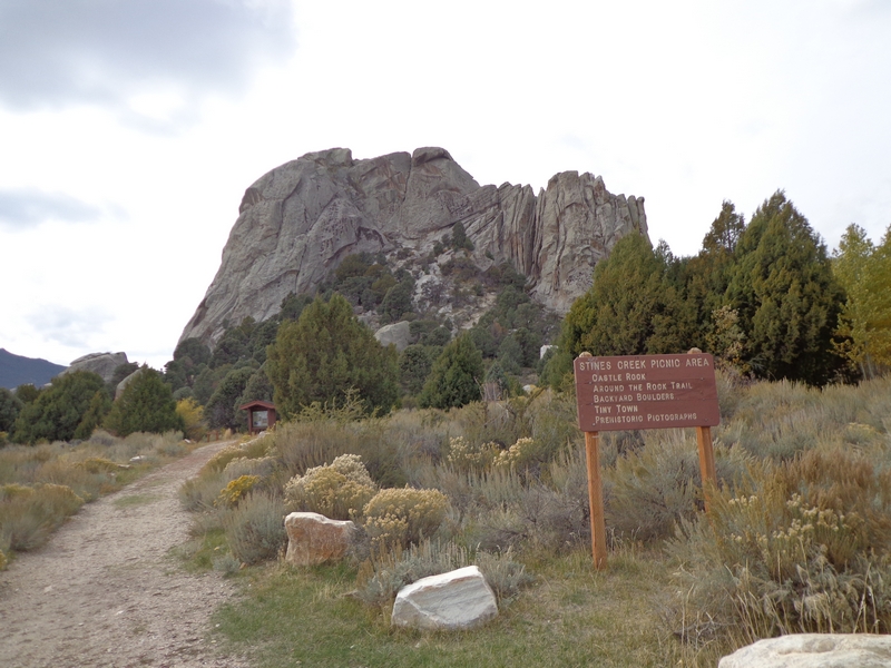

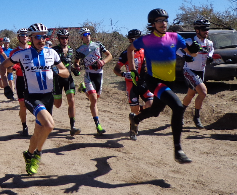
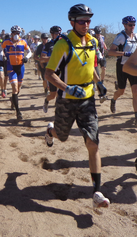
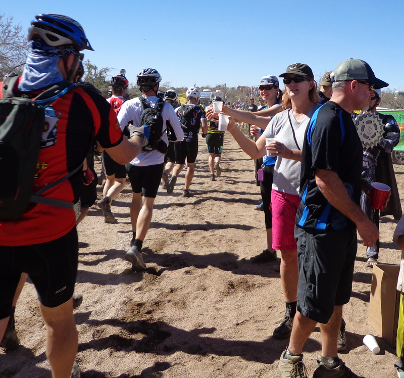
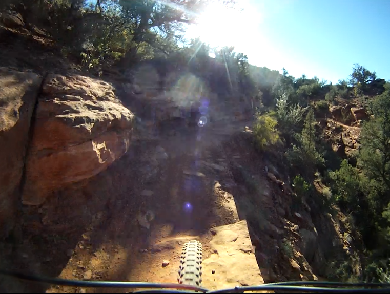
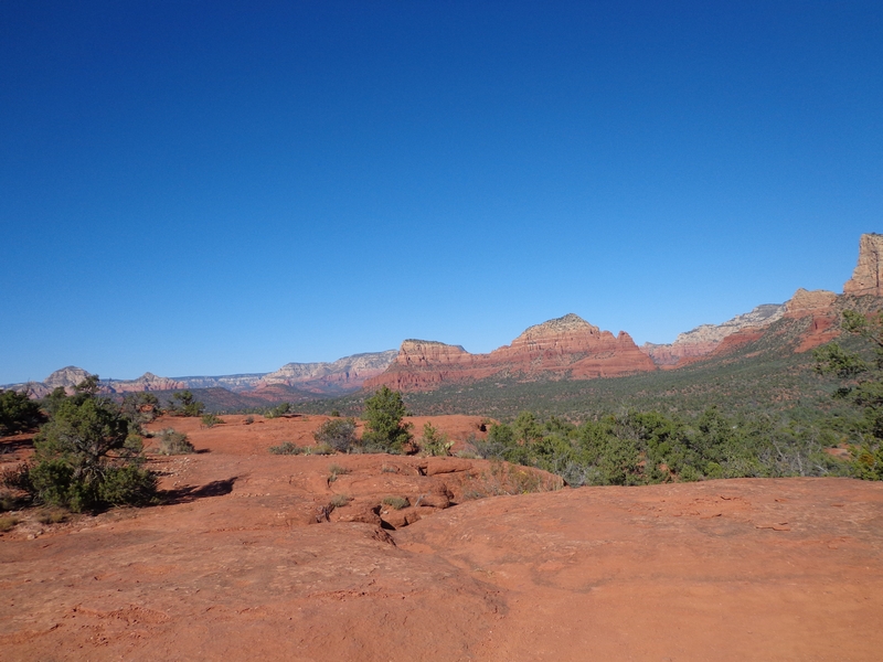
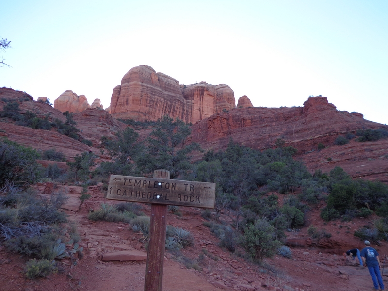
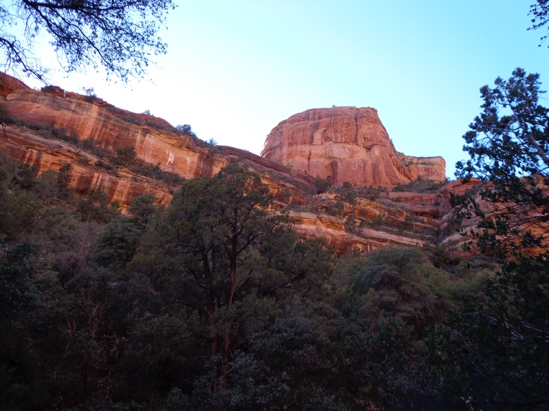
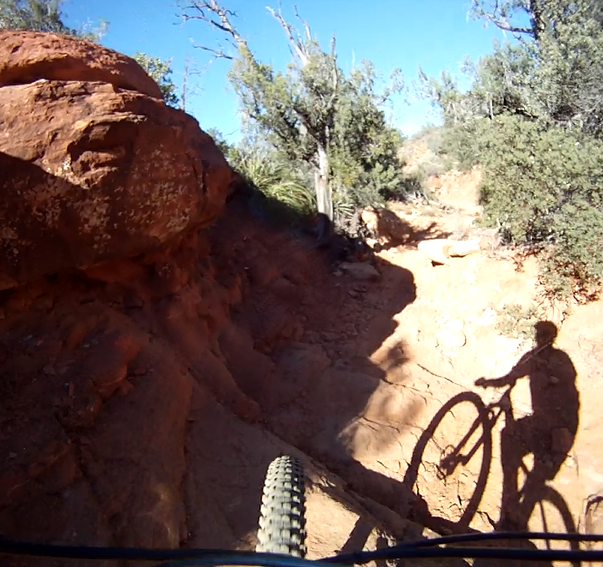
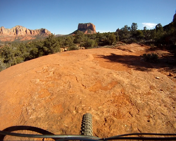
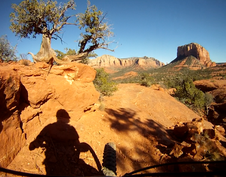
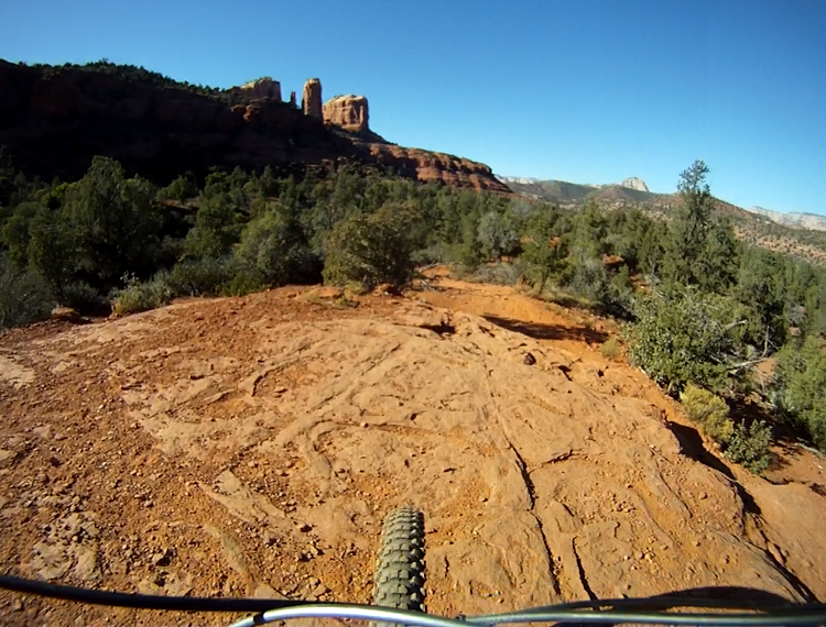
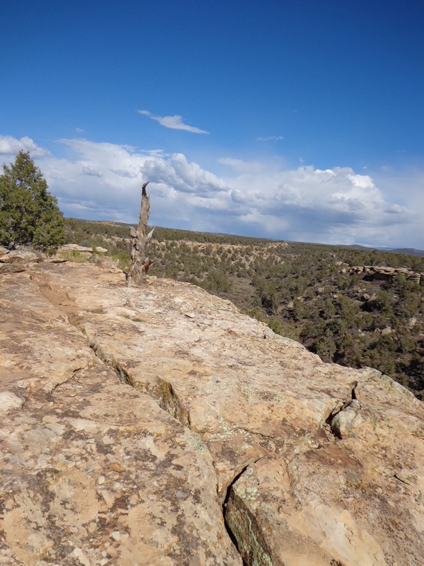
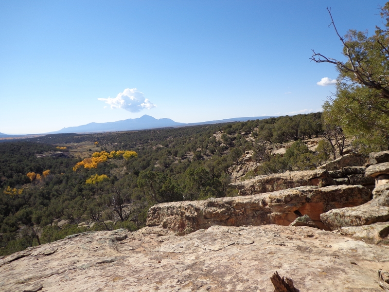
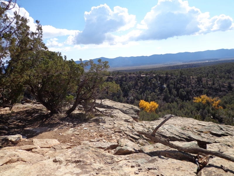
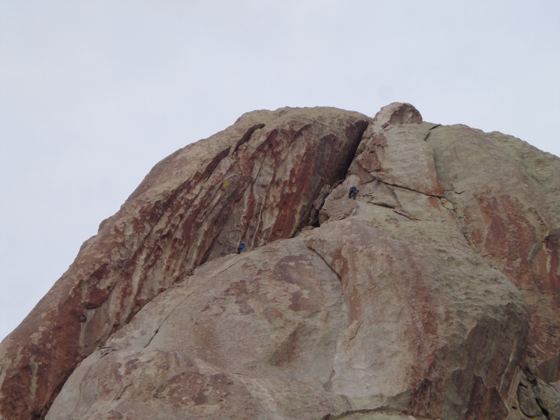
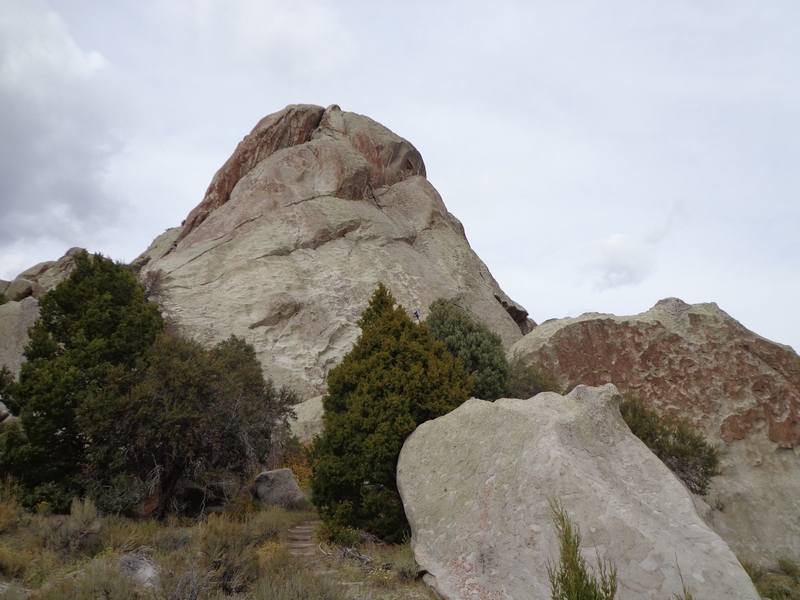