Ride Report Archive Cali 2013
There's Gold in them thar Hills.
I was spending a few days in Yuma, visiting a friend who's wife's family has property there.
We showed up on a Monday and I immediately started checking the internet for trails around Yuma.
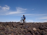
The Telegraph hill was suggested to me by a facebook friend, so I gave that a try on Tuesday morning. It was a fun ride that I was able to ride to the right from the RV Resort.
The down side was that it was way to short, maybe a couple two or three miles of single track, some free riding across the desert, and a mile or so of rough and rumble utility access road.
The single track was superb but just not enough of it. Good challenging climbing with rocky features that turned into a great descent on the way back with rock drops and jarring rocky rumble descents.
Later, I found an article on mtbr.com that talked about a trail system in the
Laguna mountains that contained a large network of trails.
I headed over there Thursday morning, ready to take on some single track.
To my disappointment, when I pulled up to the area that was pictured in the article there were no trespassing signs. The area looked like it had been shut down. County Public Works No Trespassing signs everywhere I looked. I Looked for alternate parking but could not find any.
Next day I headed down to the Johnny Yuma bike shop (the shop had been mentioned in the article as the go-to source for information and maps). There was a young guy at the counter and an older guy working on a bike, I expressed my disappointment in seeing the signs out at Laguna and asked if he knew what was up.
The young guy, turned and said "Johnny". I looked at the older guy and could see a hint of frustration on his face. "The area is not Closed!", just turn left after crossing the canal and take the dirt road for a couple of hundred feet to a wide area and park there.
The trail will take off and head around the fenced in area where they store tires. Or you can go up the road for another half mile or so and take Ryan's trail.
I thanked Johnny, got a map from him and left.
My wife and I drove out to check out the parking and see if we could find the trail head, it was just as he had explained.
We spent a couple more days with our friends then extended our stay at the RV Resort so I could ride the Laguna trail system on Saturday.
After studding the map, cross checking with Google map (in satellite mode) and re-reading the mtbr.com article I was ready to check out the trails.
When we checked the trail head the other day it felt isolated so I had my wife drop me off and I would call her later. After looking at the Google maps, I was thinking of riding cross country on dirt roads to highway 95 having her pick me up there later.
I headed across the canal to turn onto the dirt road and rode up to the parking area, four cars were parked there.
A couple of pedal strokes across the lot and I rolled a berm to drop onto the trail, called Front yard.
The tread was smooth and the line wound back and forth along a dusty track, paralleling the tire reclamation area.
A quick up on a gravel berm and the trail ran right next to the fence, following it down and around the corner before taking a turn, marked by a couple of cairns, to start out across the desert.
The trail climbs at an almost indiscernible grade as it rolls over low level ridges and swoops through the shallow swales.
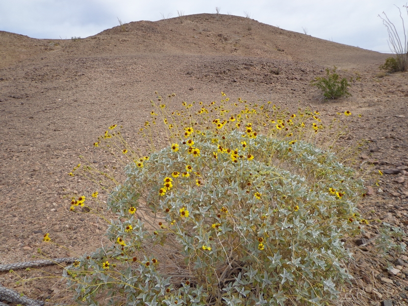
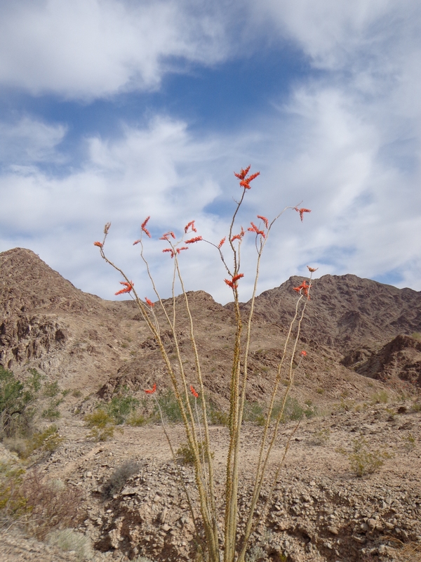
Dropping at one point from the bleak desert surroundings into a wash, the sandy bottom covered with desert flora, the bright yellow blooms of Brittlebush and the thick dark greens of the Saltbush and Creosotebush.
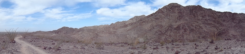
The desert here is like I have always imagined a desert would look like...stark, bleak and harsh.
Winding across the desert, the trail drops into a small valley that it follows up, winding and twisting as it traverses the slope above the narrow valley bottom, to break over the top of the hill onto a barren black plain. The rocks have a fired black look.
The line rolls across the blackened moon scape to pass a spot where a quad or jeep has accessed this plain and decided it was a good idea to rip off a few cookies. The black reptilian looking surface broken with large white swirls.
The trail merges with a double track to follow it for a hundred feet then peals off to take on a more challenging section of trail.
A little climbing to the top of the ridge, a saddle between two peaks, where I stopped to look over the lay of the land and saw a rider on the top of a ridge, across from me. I watched as four riders appeared and rode down the ridge to cross over to the back side and disappear from view.
I turned my attention back to the trail that ran across the exposed surface of the hillside, riding around the mountain, the trail presented a descent.
The line ran downhill at a moderately steep grade with some rocky drops and twisting transitions until it rolled out onto a double track.
The trail was not obvious to me so I followed the mountain bike tire prints in the dirt that led up the double track.
There was a line that diverged from the double track to present a large rock roll, the approach and exit both filled in with well placed stones
I followed the double track that dropped into a wash, the track turned to follow the wash, soft gravel interspersed with chunky sections of rubble.
I was grinding my way up the wash when I rounded a bend to find a guy in a small encampment, that was set up in the wash.
He had his back to me as I rode up, intent on a machine that was buzzing away. A cloud of dust hung over the machine as he dumped some dirt in the top.
He was somewhere in his late thirties to mid forties. Thin and clean shaven, he did not look like I would have though a miner would look, he was wearing a dark gray tee shirt with light colored cargo pants that had been cut off just below the knees, he had on high topped lace up boots with a large brimmed straw hat, that seemed rather tall, planted his head.
I hollered out "hi" as he turned in a start.
He responded to my greeting and I asked if he had seen any other bikers, he said he had not but had heard a couple up on the hill behind us.
I asked what he was doing and he said he was looking for Jimmy Hoffa.
Seems like it would be pretty hard to identify him after all these years, I replied.
He laughed and said I'm look-in for some go-old.
I asked how he was doing and he said I'm do-in all right.
Curious, I asked "what made you chose this spot" and he pointed at a rock outcropping along side the wash, then he went on to tell me that although this was not the biggest bend it was the most abrupt. That through the ages, water had flowed down the now wide valley and hit the outcropping, causing it to swirl and eddy. He then pointed out the large mound of gravel that laid in the middle of the valley and how it was both separate and different than the hillside, a hundred feet behind it.
I said good by and good luck as I headed out and he asked if I needed water, a very friendly gesture.
I spotted a line running up the hillside as I left his camp and after a couple more twists in the gravely wash I turned onto the trail.
A steep climb that was a mix of loose rubble and rocky outcropping. The climb had me off to push my bike for about ten feet twice.
The trail broke over the top of a ridge and crossed a double track. Looking at the map later, I think this line was called Bart.
This was the trail that I had seen the other riders on earlier, it is a fast line that runs across the side of the hill until it gains the top of the ridge a few hundred feet on down.
I blasted down the ridge line, my weight back and switching my forward foot every few hundred yards as the line followed the contour of the ridge.
The tread, loose and gritty made the fast descent a little sketchy. Johnny had warned me that it could get a little dicey if you lost the line.
The track was very narrow and on a few of the corners it felt like my front tire was drifting a little.
The trail ended by flowing through a couple of washes, winding through the desert bushes and dumping out eventually in the county yard, where there were large culverts and other road maintenance supplies stored.
I wanted more and Johnny had told me about another trail head about a half mile up the canal road.
I rode up the dirt road, which had a few fun spots on it, until I thought I should have seen the trail head. There was a transmission line running parallel to the canal and I figured the trail would have to cross it at some point.
I followed the service road back toward the parking area and found the Ryan trail quickly where it crossed the service road at a power pole.
Much like the last trail, the line is a moderate climb through the black rock desert terrain broken up with quick little blasts through the small washes that divide up the hillside.
The trail breaks over the top of a ridge line to turn and follow a ravine on a fast downhill to whip across the bottom through another wash and back into the climb.
Not long into the ride there is a trail junction, unmarked like all the junctions.
Without a map I am just playing it by feel. The junction looks to me like another trail splitting off the Ryan trail. I am trying to head in a southern direction while trying to climb higher into the hills. So I leave the Ryan trail and start climbing on the Backyard trail.
The trail climbs the side of a ridge to break onto a saddle. A good spot to look the terrain over, to scope the line as it continues to climb at a lesser grade as in traverse the ridge.
The top of this ridge is gained and another fast run develops as the trail heads down the side of the ridge towards a wide wash.
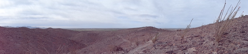
Crossing the wash the trail flattens out as it crosses yet another plain of blackened rubble.
The whisper of a line across the plain is marked with double cairns ever hundred yards or so.
The trail turns down to make another fast descent down the narrow single track I was surprised by the only switchback I have seen in the system. A quick turn and run into the bottom of the wash.
The trail offers a couple of options, the line marked with a couple of cairns on the left and an obvious line on the right, my internal voice says take the narrow single track but my logic says take the marked line, they marked it for a reason, so I drop through the dry stream bed and ride out across a wide flat expanse to swing around and merge with the narrow single track that had taken a more aggressive and sketchier line across the side of a steep slope.
The trail runs through a saddle between a couple of hills which exposes a wide wash with a double track running through it.
Dropping down into the wash the trail disappears into the double track.
Riding up the double track I notice a boulder next to the road, it looks familiar with a built up approach and roll off the back side and I realize I am back on the first trail and up around the bend is where I had run into the miner.
I don't want to take the same route and I still need more climbing.
I survey the hillside off to the north and see a faint line running at the base of the hill, just out of the wash. The line looks like it terminates because I don't see it climbing on up the hill but decide to go check it out anyway.
Dropping back down through the wide wash on another double track, I pick up the new line, the Johnny Walker trail.
A quick run out to where the line looked like it terminated and I see it drops down over a very steep bank. This is probably the most technical spot I have come across yet so I drop back over the rear wheel and roll over the edge into the wash. With a flash I'm across and jump up to crank up a steep bank and gain the flat on the other side.
The trail wanders up the wide wash, crossing back and forth from one flat to another. The trail a little rough at times, in terms of staying on track. At one point I lost the trail completely and had to back track a few feet to find the line.
After about ten minutes the track made a turn and disappeared again into a faint double track, that led to a stronger double track that led to a dirt road.
I scanned the surrounding hills and could not see a definitive line.
Looking at the tread I could see some tire marks headed up the road so I turned south and started following the road.
The road had a couple of climbs that were so steep and loose that I had to get off and push.
After five or six minutes I reached the top of a peak and could see a very definitive line crossing a hillside off to the east, the Sidewalk trail.
I headed in that direction, the exposure of the trail on a very steep hillside looked a little extreme as I approached, thinking to myself, I could always ride back down the double track if it is too much.
When I reached the trail, I didn't give myself a chance to second guess and made the turn onto the trail.
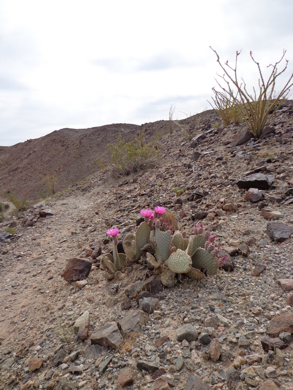
The line ran across the steep hillside and I just kept my focus on the narrow, dusty white line that was carved into the black rocky hillside. The trail made a turn around a sharp ridge line and I ducked as I passed under an ocotillo cactus that was hanging across the trail.
The line swooped through a small valley and up onto the top of a narrow ridge.
It was probably the best run of the day as the narrow line stayed on top of the knife edge of a ridge to blast all to quickly down the winding rumbling rocky descent.
The trail terminated on another double track, a continuation of the road I had been on, high up on the hill.
Again, following the tracks of other bikes I headed north, to take a turn to the west that dropped high up into the wash where the miner was working.
I rode the wash down until I came to the trail I had climbed after talking to the miner and again found my self unable to clear the climb, pulled from my bike twice in the ascent.
When the trail again broke over the ridge I followed it down the same path, planning on taking a turn to the south that I had seen earlier in the day, but within a couple of minutes I spotted another line to the south and took it.
The ridge ride was not as fast as the one just north of me. It had lots of rolling peaks that presented a short fast descent, followed by an almost equally short fast ascent.
It was a very long descending trail that had a couple of junctions where I kept to the left to try and keep my course headed south.
Toward the very bottom of the trail I stumbled through another switchback, the second of the day and I am afraid I have lost my touch since I had to dab my way around the very steep corner.
Making the road that paralleled the canal I turned toward the southwest and follow it until I was able to cross it and make my way to the highway 95.
The tread is consistent through out the tail system, an aggregate surface where the rock could pass as graded as in a rock quarry where they have a grading system that uses screens that the rock filters through. In the case of the tread on these trail the consistency would be a one point five inch minus.
The climb a little more challenging, the tread giving way when the ascent is pressed by standing up to crank out a short steep. The descent a little sketchier as the trail presents sections where the rubble fills the middle of the trail and the fast line is maintained by railing the high side.
If you are ever in Yuma and dying for a mountain bike fix, this is the only option. Be sure and stop by Johnny Yuma's Bike Shop and pick up a map. I only rode a fraction of the trails that are here and it would take a half dozen trips to become familiar with the layout and touch on all sections of the system.
The Johnson Ridge - Irish Open Spaces
Headed north, we made a stop in Bakersfield and I got to ride the
Mr Toads Wild ride again. That is probably the most fun you can have without having to buy a ticket.
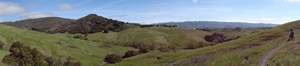
Next stop, Lake Santa Margarita, outside of San Luis Obisbo. There are a few trails here and I have ridden two of them, Rocky trail is a short three and a half miles our and back, with a good climb at the turn around, not technical but fun and it did give me a workout for the short four miles of riding that I did.
The Gray Pine trail, turned out to be a good ride, at about seven miles it presents three ridges to cross with one being a very stiff climb with eight or nine switchbacks. The trail has some tough climbing but nothing technical, a very good workout.
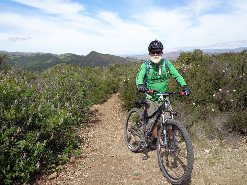
I checked in with Facebook friends and was able to connect with Darius and his wife Lisa who were in the area. We met at the Johnson Ranch open area to explore the trails system.
Darius and Lisa had ridden there the day before, starting at the Irish Hills Natural Reserve and riding over to the Johnson Ranch. They wanted to do the Johnson Ranch loop, a little over three miles in length.
I had not seen Darius since last fall and it was nice to meet up with him again for a ride, I was expecting a challenging experience.
Darius posted to the
MORCA group that we would be riding there and it would be a casual pace if any one wanted to join us.
We met at ten on a Thursday morning, the weather was perfect for a ride, temperatures were in the low sixties and would probably hit the low seventies by late afternoon.
The parking is limited and there are lots of hikers, joggers, and walkers accessing the trail. The vehicle turnover seems to be at a fast pace, in the twenty minutes I was there, waiting and getting ready. There were at least four cars that left.
There is a map board and information center, just past the trail entrance, a box with small bells mounted on Velcro straps is located on one side of the board. The
Central Coast Concerned Mountain Bikers, CCCMB, has provided the bells with a request that mountain bikers attach a bell to their handlebars. A means to warn hikers and joggers that a mountain biker is approaching.
The trail starts with a short drop and turn across a small bridge to flow into a mellow climb for the next mile or so.
The path was lined with thick patches of white flowering flora, that I think may have been Cow Parsnip or Yarrow.
At just past a half mile, there is a small loop that spurs off to the right, if you are riding the trail in a counter clockwise direction. The loop, one and a third miles in length, offers a little more climbing and extends the main loop to a full three and a half miles.
We bypassed the spur on our loop and continued on the mellow climb up through the spring grass and flowers. The wild flowers were exploding with color. The California Poppy lined the trails and there were huge patches of blue bush lupine with sprinklings of what looked like yellow Golden Fields flowers popping out all along the line.
The trail took a turn down hill as we approached the upper end of the little valley it was circling. A nice fast run on a super smooth line that swooped down the hillside and through small groves of oak.
A couple of wide switchbacks to drop down and cross a small creek on a wooden slatted bridge. The trail re-enforced with pavers before and after the bridge, making the line just a little narrow and a little more technical.
Another mellow climb across the side of the wide open green fields to gain the high point of the ride and start the descent back to the trail head.
The descent is fast and smooth, the tread firm compact dirt with the line flowing around the ridges and through the little valleys. There are a couple of little rumble spots as the trail enters a small oak grove, the line makes a sharp turn while presenting a small patch of boulders, then just before exiting the hillside there is a small rock garden to negotiate.
When we reached the trail head Darius told me that he and Lisa had ridden from the Irish Open Spaces over to do the upper loop yesterday.
Darius pulled out a map of the combined trail system, The Johnson Ranch and The Irish Open Space. He poked at the map, asking if I wanted to ride out to the Morrow View trail. Since this was a new system for him, he was hoping to make the ride out there today.
I was up for the ride. We had just done a super fast fun warm up loop, in my view, and I was anxious to see what the system had to offer.
Lisa had been out the day before and ridden the connector trail over and back. She had heard that the creek trail, on our route, was pretty rough and she was content to hang back and take another lap around the Johnson Ranch loop.
Darius and I headed back out, following the same route we had taken earlier.
We climbed for just over half a mile then turned off on the smaller loop.
The trail climbed to cross over a cattle guard, a small tubing structure that ramps up, across, and down to the trail.
The line is a nice pump and glide run across the wide open fields. A strip cutting across the hillside.
The trail turns into a valley and starts a moderate climb through a field then crossing a couple of slatted bridges the trail turns to follow a creek, under the oak trees, up the valley to a trail junction.
The junction is with the connector trail that leads from the Johnson Ranch to the Irish Open Spaces,turns to continue climbing up and gaining the top of a broad ridge.
The single track follows the ridge line up through the wide fields interspersed with large oak trees until it morphs into a double track that enters private land.
The double track climbs at a constant rate with a couple of breaks that let you glide for a few second until it turns back into a single track and takes a turn to traverse the hillside.
A great section of trail that runs across the brushy hillside, a mix of chaparral, sage and maybe some manzanita. It was a rugged cut line with lots of rumbling rolling track. The trail was a mix of exposure and brush covered sections, the exposure exposed lots of great views out over the country side, if you could take your eyes off the tread long enough to see them.
The chunky line carried a slight uphill grade but was very ride-able in a mid range gear.
Darius told me that yesterday when he and Lisa had crossed this section and at one of the more technical rocky sections, his bike decided to take a different line, one of those moments when the bike turns downhill (off the trail) and you have a choice, step off or crash, Darius stepped off and was still able to grab the bike as it was departing.
We exited onto double track and cruised down it for a few seconds until we turned down hill on a utility road.
The utility line was very steep, I hated scrubbing elevation on this kind of descent.
In just a few minutes of quick descent we picked up the single track on the top of a saddle, the trail turned to run down to Froom Creek.
It was another great bit of trail and the descent was a fast rolling chunky line that deposited us at an intersection with the Froom Trail and a secondary line that ran down the south side of the creek.
We headed down the fast line that was the secondary trail. It only took a few minutes to ride the trail out and cross the dry creek and pick up the Froom Creek Connector trail.
This connector trail ran across a grassy hillside, much like the trails over on Johnson Ranch, a fast and smooth descending line.
We flashed across the hillside with the roof tops of neighborhoods and shopping malls spread out below us.
In a few moments we were at a trail junction with the King Trail. The junction offered an up or down hill course, we turned to climb.
The King trail rambled through a few clusters of Oak trees, crossing a couple of small creek beds on slatted bridges then turn to climb up through an open area through a series of switchbacks.
The tread on the climb had been smooth and a very consistent crank cadence was carrying me up the hill.
Darius pulled to a stop after making a switchback, looking up the hill I could see he was catching his breath before taking on the uphill rock garden that awaited us just a few feet up the hill.
A challenging bit of rough technical climbing. The trail was serving up a series of rocky plateaus, each seemed to be a little more difficult than the last. A short up with a few medium sized stone planted then a flat for a quick recovery, followed by a couple of line options. I chose to stay high on the line which took me up and over a couple of large boulders and into a momentary bike stand before powering into a long section of rumble up a moderately steep grade. The tread a mix of rocks sets, the size of footballs, and quick sections of loose rubble.
The sections were just long enough to power through and make the next recovery zone.
The trail hit a switchback with a tough technical rocky up to then widen and flatten out as we rode up the top of a ridge.
The open field again gave way to a brushy line. The trail turning to climb a moderate grade with lots of rock and rubble. The only strategy I could come up with was to power over the large rocky stuff and look for the line of least resistance.
A few minutes of climbing and we reached a paved road. The trail took a turn to follow the road up a steep grade.
We started grinding out the climb, I was expecting this to be the norm for a while but was surprised when after a few minutes the pavement came to an end and a wide single path headed up a very steep grade.
The path up through the brush was full of rubble with a firm line moving to and fro through the rubble. The trail was full of challenging rocky features that required plenty of torque to clear but the steep grade dictated a pace to conserve power when ever possible.
We continued the climb with the trail forcing both of us from our bikes a couple of times to push a few feet to gain solid ground before digging in and pressing on.
After a hard, sweaty climb the line finally broke onto the top of a ridge and presented a fine view.
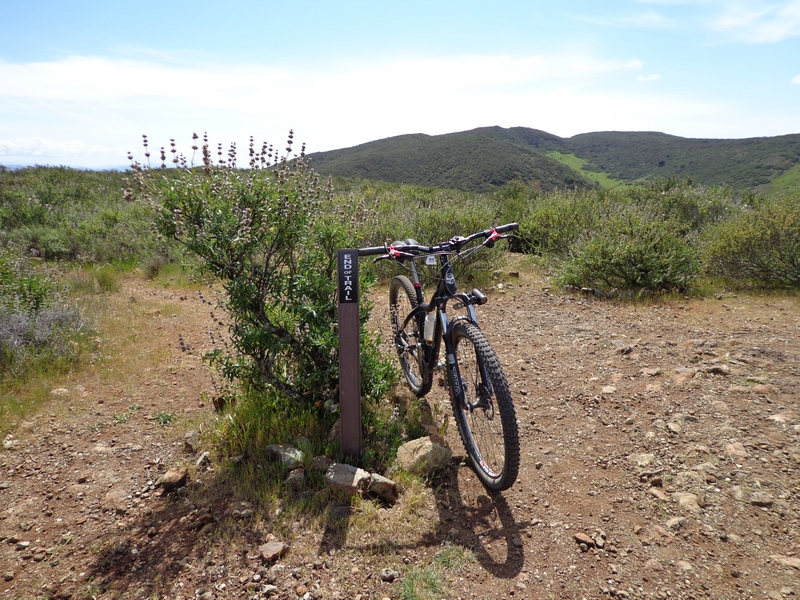
We followed the trail for a couple of hundred feet, a trail marker which declared "End of Trail", so we took a few pictures of our bikes and headed back down the trail.
The descent was fast. The key being to keep your weight back and roll the large rock drops while maintaining enough momentum to carry you through the rubble and back onto solid tread.
On the way up we had passed a trail junction with the Poppy Trail. Darius was sure this would take us down to the Froom Creek Trail, so we took that line.
The Poppy Trail's tread was smooth as it ran flat along the top of the ridge for a few hundred feet or more, then it turned to traverse the ridge line and descend into the valley.
For the most part the tread was much the same as we had seen on the Morro Trail; a mix of firm packed dirt with sections of rubble.
There were a couple of short sections where the line twisted through large angular boulders with one little bridge crossing as the trail descended through some steep inclines until we reached the valley bottom and the Froom Creek Trail.
The trail made a one eighty turn and headed down next to the dry creek bed.
The Froom Creek line starts off with lots of gravel and loose rubble, the incline was no where near the grade the Poppy Trail was, it provided a fast wide track.
The line is constantly transforming, a solid firm line weaving back and forth through the gravel and rubble with solid rock and rumble sections. A very fast descent that forced me into a low profile on the bike, my weight back and arms out stretched. Watching the front wheel bouncing across the rocks and focusing on the little path that cuts through the rubble. The line shifting from one side to the other as I trace the narrow path that has formed from use by hikers and bikers running this trail.
We made a stop for some bikers making the climb up the trail, a welcome rest to shake out my hands and stretch my legs out.
We crossed Froom Creek to take the connector trail back up to the utility road, the trail ran almost as good uphill as it did on the descent. The trail has a very good profile, it rises and descends on a rolling line which has you up out of the saddle for a couple of seconds pumping hard, followed by a short roll and glide before jumping back up out of the saddle again.
The utility road climb was just as I expected, dig in and grind it out.
The connector trail that connects the two areas is a fun line. The trail again has a good profile, the return lends itself to a fast pace. The trail rolling up and down while twisting across the hillside, following the natural lines and taking advantage of every dip and mound.
The run is fast and dumped us back out on the double track.
The double track is a very fast downhill line that is crossed again and again with water bars that lend them self to a quick kick or hop.
The double track trail flows back onto the top of a ridge and descends fast to turn and head across the side of the ridge and the wide open field. This time of year the open area is very green. Beautiful pasture lands with groves of large oak trees. The trail returning to the single track once again.
The flow of the trail is interrupted briefly by a cattle guard as the line dives down into a small ravine and crosses a short slatted bridge.
The trail continues the pastoral descent, traversing the hillsides until it arrives back at the Johnson Ranch trail, where we continue to ride the loop back to the parking area.
Four days of the Sea Otter Classic.
The Sea Otter Classic in held each year at Laguna Seca Raceway, held in the spring it is a four day event.
The MORCA crew has a Wednesday night ride, that on this night before the Sea Otter Classic, was leaving from the Laguna Seca Grand Prix camping area which is on the edge of old Fort Ord.
I parked my rig at the fifth corner parking area, so called because it is on the fifth corner of the race track, and headed up the pavement into the Grand Prix camping area.
We all met at the official camp of the MORCA group.
The ride was to split into groups, the advanced, intermediate, and beginner group. There were no beginners so we all took off together.
The trails in the Fort Ord complex are all numbered and we took off on trail 47.
Trail 47 is a loop trail. The line drops right out of the gate, literally. A very steep rutted grade that drops and turns to follow a fast single track traversing the steep hillside.
The trail turns through a switchback to descend at a fast clip, the tread rutted and ribbed with breaking bumps. I found myself riding high on the line to minimize the chatter as the trail widened out and descended sharply.
The trail rolled as cut through the tall grass mixed with large patches of bright blue lupine in the wide open fields of Old Fort Ord.
As I blasted down the line, I saw Darius (the ride leader and president of the club), standing off to my right in the tall grass. There was a narrow path leading off the trail and up to where he was standing. I turned off the trail and coasted to a stop in the tall grass.
We waited a few seconds as the rest of the group caught up and he told me this was the original trail 47. Pointing out across the field he suggested we could ride this line, I heard some scoffing and coughing behind me, so four of us headed out across the field on the rarely ridden line.
The main group headed on down the hill on, what is now trail 48.
A hint of a line ran off through the tall grass, a narrow track just barely the width of a mountain bike tire, was visible as it passed under large oak trees and wound across the hills.
The trail climbed and turned to traverse just below the ridge line. I cranked hard in a moderately tall gear as we powered our way up a low grade assent.
As the trail ran from the tall grass into a patch of chaparral and sage the line became wide and well defined.
The trail made a fast steep descent down through a little valley and out through the tall grass to cross the top of a ridge. The trail breaking again to descend down a steep rutted line, running fast under the shadows of a grove of large oak trees.
The descent was a fast blast down through the open fields of tall spring grass sprinkled with the flowering blue lupine.
The trail wound its way across the hillside dropping four hundred feet in elevation as it approached Hwy 68 to turn and start a return climb. A real grind it out steep climb.
The ten minute loop returned us to the original line just a few hundred feet from where we had diverged from the main trail.
The rest of the group had a good ten minute lead on us.
The main trail was a fast run across the top of a wide ridge to drop off the left side and circumvent the hill.
The trail traversing the side of the hill until it circled around and dropped off the far side, scattering sheep grazing on the top of the ridge.
A couple of quick sprints on the flat of the ridge to make a wide sweeping switchback and drop off the ridge on another fast descent, weight back and hugging the high side of the line, again looking to smooth out the breaking bumps created by out of control riders.
The trail dropping to the bottom of the valley and crossing a dry steam bed to start a moderate climb up the other side.
The climb took me up and over another ridge and presented another fast descent that dropped me into a soft sandy wash at the bottom. I felt a little out of control drifting across the sand wash, throwing my weight back and relaxing my grip to let my bike float through the sand.
The line was visible across the far hillside, a long climb on a descent grade with a couple of strong power up sections and the rest a low mid range geared climb to gain the top of the ridge.
As we were riding up the ridge, Tom, who was riding in front of me, dropped back and pointing up ahead, said "they call that the hurl section". I looked at the vertical climb in front of me and thought, that doesn't look that steep.
I started gearing down, the climb was thankfully staged in three section, each with a very short plateau at the bottom of the section. I was in my lowest gear before I reached the second section and was putting my all into the last bit of the climb, the power of suggestion hurling across my mind.
The single track disappeared and a light double track ran down the top of the ridge to junction with gravel and the Skyline Rd.
We scrubbed elevation on the descent down gravel. The other riders were flying down the road, gravel always makes me nervous.
The Skyline Rd junctions with Oil Well Rd, and we stayed on Skyline, continuing to scrub elevation on the gravel road.
We finally hit a single track, trail 44, that split off the gravel to head out across the field on a narrow line, rounding a ridge and dropping down a fast rumbling wide descent through breaking bumps and short sandy stretches of trail.
There were a few short jump up and crank sections before the narrow single track turned into a wide line cutting through the end of the ridge and starting a fast swooping descent.
This trail has a great line, smooth and fast it has some very big banked corners and in one spot brought Hood River's Post Canyon Grand Prix line to mind. The corner wide and high, then dropping to blast down and into another huge corner.
The trail dumped us onto gravel on the Three Sisters Rd. A gravel climb and descent over a couple of small but strenuous hills to pick up another line, trail 42.
As we turned onto the trail, Ken told me that the trail had been developed by volunteers from MORCA with help from the BLM, and told me to watch for the trail change from BLM construction to the volunteer construction.
The trail was wide and ran down the top of the ridge for a short ways then took a turn to descend through numerous switchback. The tread a rough bumping wide line running across the hillside.
As the trail rounded the front of the ridge, the wide line abruptly changed to a narrow single track. The dense brush gave way to oak trees and tall grass.
The line twisted and turned, a narrow descending line with nice flow that ripped through the woods to drop down and finish at the end of Skyline road.
We took a turn onto Skyline and followed it back up the valley for a short ways to a connector road that put us on Pilarcitos Canyon Rd.
Pilarcitos is a moderate uphill grade that had me head down and cranking for the next twenty minutes to the intersection with Skyline Rd again.
A quick shot down Skyline had us back to trail 47, making a turn and heading up hill for a short push put us back on single track for the final blast back to the trail head.
The line running in and out of small valleys and providing lots of rumble up to the final turn and a very sharp ascent back to the gate, which caught me and most of the other riders, pulling us from our bikes to shift down or push the final fifty feet.
I had been corresponding with Wilt from
JensonUSA, he was attending the Sea Otter Classic and had asked if anyone wanted to take a ride on Thursday.
I met him at the Focus bikes tent where he was negotiating a demo bike ride.
A little tweaking on the bike and we headed out to find the demo area, with no success. We instead rode around on a couple sections of the marked event trails, spent a half hour on the demo bike then walked to his car to get his ride.
I took Wilt over to trail 47 where we rode the short trail 48 instead of the sketchy line that ran off across the hills.
Wilt had been chumming me with some chatter about having to work on getting ready for this ride in our correspondence.
He let me take the lead on the descents but when it came to climbing, he was all over it. We hit the hurl hill and he hammered his way up that.
On making the top, I ran into Ed from
Camas bikes. Ed had come down from Washington State for the Classic and was out for a ride with a friend, they were riding 47 in the other direction.
Wilt and I made it back to the trail head and then split up as I went over to see if I could find another Friend, Andrew, who was camping there for the week. Andrew was riding in a couple of events and this would be his thirteenth year at the SOC.
Next day found me doing volunteer work as a marshal on the Dual Slalom.
I would be working on a number of qualifying events and the finals on CAT1.
My first position was toward the top of the course and watched as riders would come blasting down the hill, notifying an official if a rider went down, and helping as needed.
After an hour or so, I heard someone shout my name and turned around to see Kevin from
Canyon View Cycles in Longview, Washington, waving at me. He had made the trip down just to check out the event. He and a friend had driven all day, arriving here late the night before, stopping to hit a couple of BMX parks on the trip down.
After a few hours I was moved up to the starting gate and my job was to reset the gate after the riders took off. It was interesting and my main observation here was that your take off could gain you anywhere from a half to a second and a half on your opponent or could cost you time.
There were riders that would rock back on their bike when the gate dropped, I suspect they were rocking back to gain torque but it always left them with a weak start.
The ones who gained time were poised, the sound of the timer ticking down the three beeps before the gate dropped, they would kick into the gate with a wheelie just at the moment of release, always setting up a fast start. Blasting away from the gate with the bike rocking back and forth as they peddled away and dropped out of sight before the other rider had even reached the first kicker that launched them into the downhill blast.
After lunch I was again on the course, a little lower down but a premium position to watch the riders hammer there way through the upper big banked corners and across the pump section before hitting the lower two corners. The last set of corners had a long pump section and I was very impressed by a few riders that truly have "Mad Skills", that hit it at such a blazing speed that they would literally pump it on just the back wheel.
Saturday had me meeting up with some new friends that I had met in Tucson, Karen and her husband Randy for a ride in Old Fort Ord.
We met at eighth and Gigling, a popular starting spot for rides in Fort Ord.
Karen told me some of her girl friends were going to join us.
The ride was many of the same trails I had ridden last fall with the MORCA crew, only we rode most of them in the opposite direction.
We took off at a quick pace and I figured I was going to get my ass handed to me on this ride. The only thing that probably stopped that from happening was all the regrouping we had to do to figure out which way to go, since nobody was familiar with the system.
The trails were a little dry and there were a couple of trails where we slogged to a stop in deep sand, the front wheel just out of control and the back wheel buried to the top of the rim in soft sugar sand.
We put in fifteen plus miles over a three hour ride with great weather.
I returned to the Sea Otter Classic on Sunday. I went around to all the vendors to see what kind of swag I could collect. Next time I will hit up all the vendors on the first day of the event. I was headed for the Disciple's Of Dirt Spring Barbie Camp on the following weekend and thought it would make for a fun grab bag drawing for the Saturday night bonfire.


