Mountain Biking The Siouxon Trail
Difficulty: Easy to Intermediate
Suggested Skill Level: Beginner to Intermediate
Trailhead longitude and latitude: 45 56 26N, 122 13 49W
Google Trail Head Location
 Google Directions From Portland
Description of Ride:
The Siouxon TrailSiouxon is a trail for riders of many skill levels. The upper section is good for intermediate riders. The middle section is a comfortable ride for the advanced beginner, and the end sections offer obstacles and challenges for the intermediate to advanced rider. No matter what your level, the trail is a scenic delight.
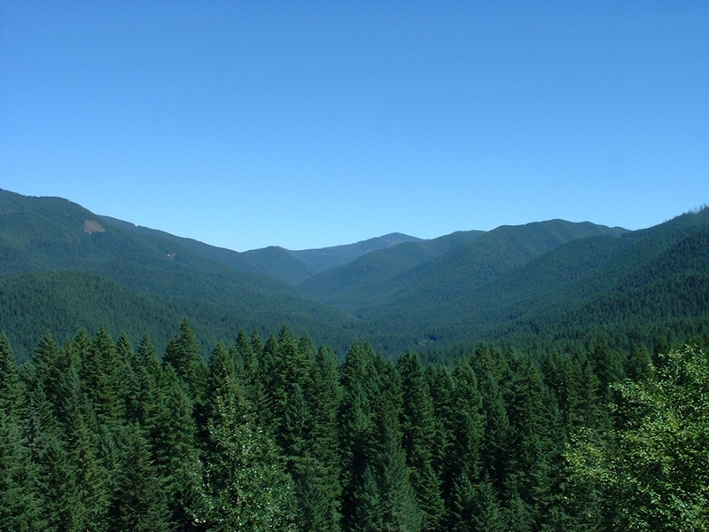
The Siouxon Valley is a roadless area. It is accessible from National Forest Road 57 and then by National Forest Road 5701. The last time I was there I was able to scan the horizon from the top of the ridge as I entered the valley and see nothing but unspoiled timber-covered hills.
A word of caution about trail usage. There are lots of hikers at Siouxon. Most will step off the trail for you if and when they see you coming. But the rule of the trail is that bikes yield to everyone! If you see someone hesitate, be sure to stop and yield. If you are approaching someone from behind, let them know in advance so they have an opportunity to find a spot to move off the trail. Please represent the mountain biking community in a positive light.
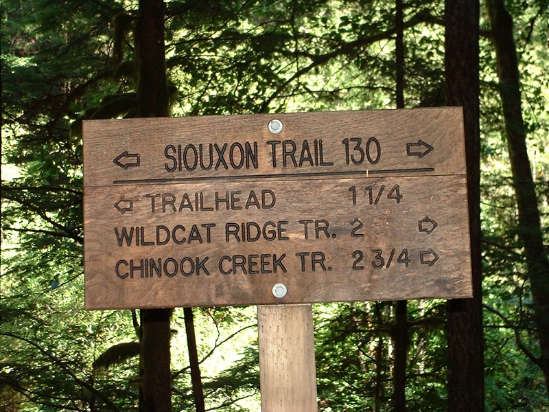
I like to start at the very top of the trail, which can be accessed by parking in the uppermost parking area that the road passes through right after entering the Siouxon Valley. The trailhead is located just after the road turns the first corner.
The downside to starting at this end of the trail is that the out-and-back ride will end with a 500-foot climb in the last mile. An option is to start at the next trailhead, which is at the end of the road and then doing an out-and-back to this trailhead. This gives you a level start with the big climb coming after two miles of mostly level single track.
From the first trailhead, the trail starts with a moderate descent, the first turn being one of the tightest switchbacks in the whole trail system.
The trail has a pretty step side slope but the single-track along here is reasonably wide. After a few hundred feet the trail makes an easy left turn and crosses a small plateau to the next descent. This repeats at least 4 times until the trail crosses a small creek.
In the area of this creek is where Hickman Cabin was located. The cabin was the base camp for fire-fighters in the mid-20th century. The Forest Service website states that it is a moss-covered structure offering a glimpse of the past. I have stumbled all over this area looking for this structure and all I found was what looked like some moss-covered rotting boards, uphill from the trail and not far from the creek.
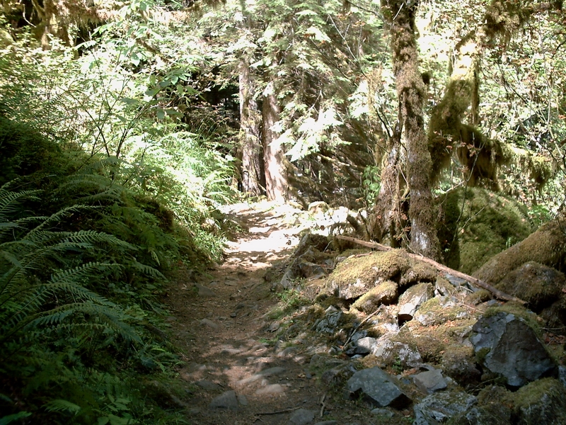
The trail becomes a little narrower for the next couple of miles. It levels out and has a couple of short, steep climbs, with an elevation change of less than two hundred feet in two miles.
The trail crosses numerous creeks over the next couple of miles, following the terrain in and out of small valleys and crossing boulder-strewn creeks. I have never been able to ride across even one of these crossings and end up having to dismount and pick my way across, stepping from boulder to boulder.
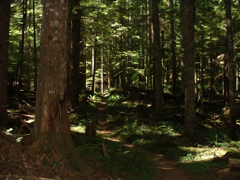
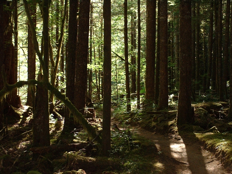
Use a little caution as you approach these creek crossings. It seems that almost all have sketchy approaches. In some case, the trail is narrow with a very strong downhill slope to the creek below and a few off-camber sections. I don't want to make this sound worse than it is. This is a great trail to ride, with excellent single-track running through a deep conifer forest setting.
At the three-mile mark the trail approaches the lower trailhead. From here there is a very steep albeit short section of trail down to a small creek (West Creek). Though this is a very steep section, the trail is wide and I have ridden it many times in both directions.
Going up this section is a matter of pacing yourself. Although it is steep, there are plenty of almost level spots to catch your breath and prepare for the next little pull.
A foot bridge crosses West Creek. It has a couple of very large steps on the approach. This is a carry-your-bike bridge.
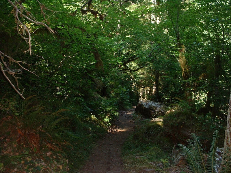
From here, the trail goes up and over a small ridge, continuing past an area that is very popular with campers. It goes over another small ridge and through a wet area until it finally starts to parallel the Siouxon Creek.
The trail is nice and wide for the next couple of miles, as it gently rolls along next to the creek. This is great riding with spectacular scenery.
At about the five-mile mark there is a short climb with maybe a hundred feet of elevation gain. The trail is still plenty wide and the climb is very do-able for an intermediate rider.
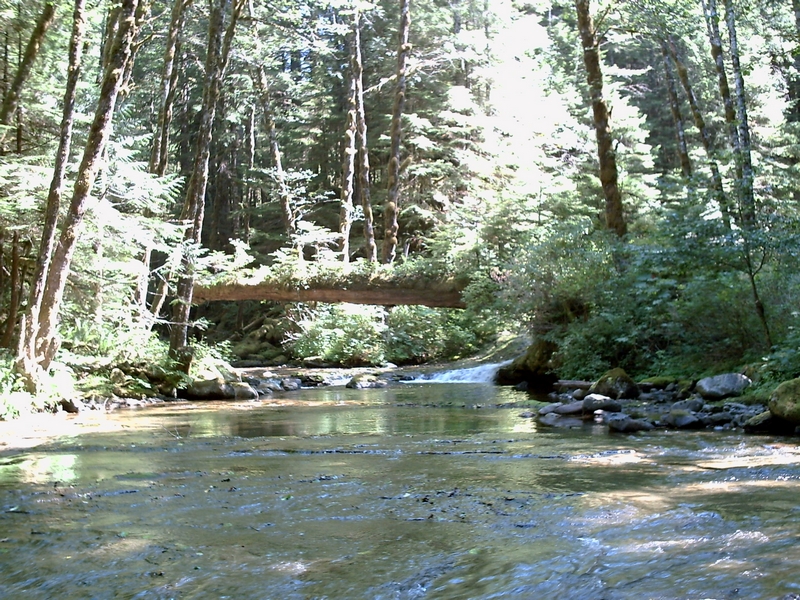
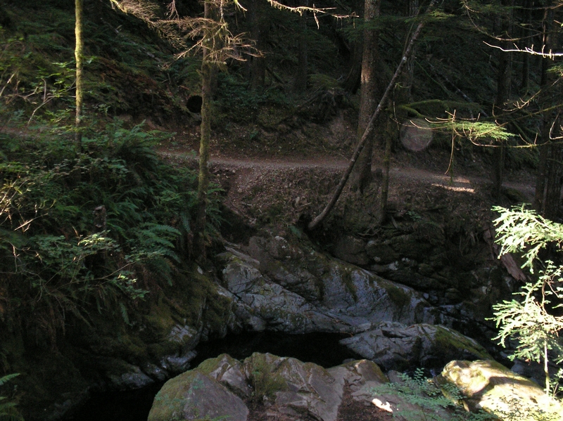
The trail crosses Horseshoe Creek at this point. There is a new bridge, built by Jerry DeRuyter, that was put in a few years back by Jerry and volunteers from Portland United Mountain Peddlers.
The stream is narrow and deep, running through a groove it has carved into the rock formation. The pool under the bridge is only a few feet wide but looks to be at least six to eight feet deep.
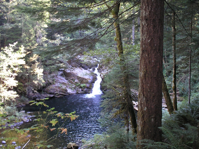
From here the trail continues on with a slight downward grade for a short bit and passes a trail intersection with a camper trail that leads down to the bottom of Horseshoe Creek. It maintains the same general trail profile, with just a couple of light technical sections, until it reaches a waterfall with a large pool.
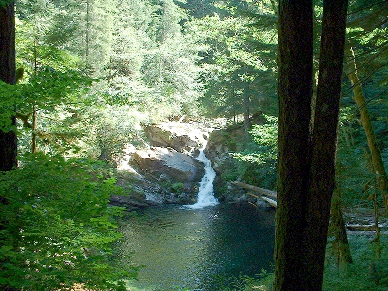
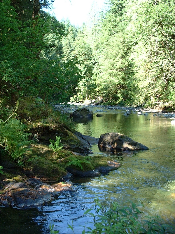
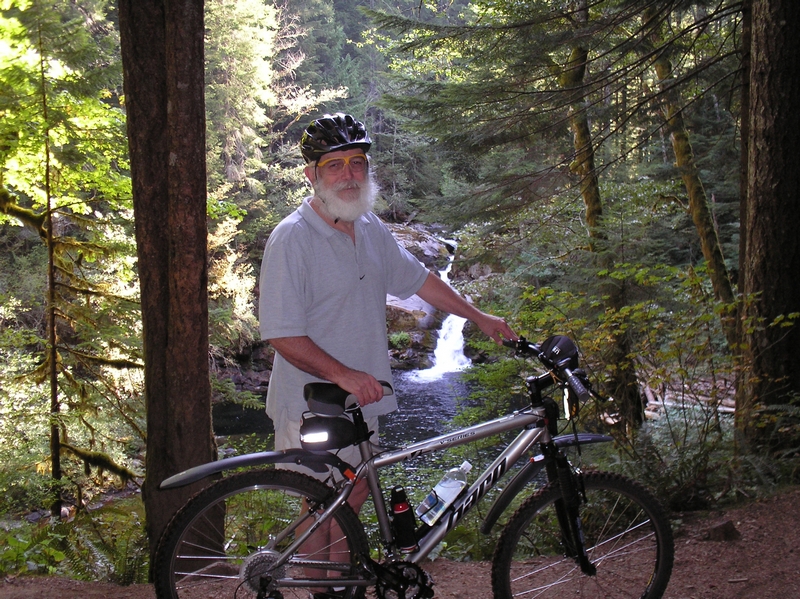
The water fall area is a very popular destination. There are a few primitive camp sites here. The trail is located high on the bank above a large emerald-green pool. Siouxon Creek cascades over a rock outcropping to form a small waterfall that flows into the pool below.
This has been the destination for a few rides where I have taken beginners. From the lower parking lot to this location is 3 miles, which translates into a 6 mile out-and-back. For a beginning rider this is an excellent venue. It gives them a couple of challenges, but they are able to handle most of the ride without having to dismount and walk.
The trail continues beyond the pool, circumventing it on the south side. Once beyond the pool the trail narrows and becomes somewhat more challenging. It continues along the edge of the creek, gaining elevation and crosses a spot or two where the penalty for a mistake could be pretty high.
There are a couple of rock gardens that are very challenging as the trail moves a bit further away from the creek. It climbs a little only to return on a rocky descent to the forest floor once more.
There is a trail intersection along here with Horseshoe Ridge Trail #140
Just a short distance beyond this is another trail intersection with Trail #130A the Chinook Trail (not to be confused with the Chinook Trail which runs past Silver Star Mountain). The Chinook Trail climbs a little over 1,000 feet in less than a mile and a half to end of Forest Road 6403. Do not attempt to climb this. One of my friends has descended this section. He said it is technical, with rock gardens and tight switchbacks.
Just as the trail approaches the intersection it crosses a rock formation which has a spring or some un-named water source that flows across it and spreads out to a thin layer of water. The one time I rode past this point I was with some aggressive riders that stopped and rode this technical section a number of times; but they were never quite able to make it across without putting a foot down at least once.
Beyond here the trail becomes narrower and begins to climb. It gains a few hundred feet and runs high above the creek.
This section is good single track trail, not too difficult but more challenging than most of the rest of the trail.
The track finally ended at a creek crossing, where there was a rock formation that caused the creek to spread wide across it. This is where the ride ended for me and the group I was with.
I am not sure how ride-able the trail is beyond this point, in fact I don't even know where the trail continues. I have made an assumption, based on maps that the trail continues on the other side of the creek.
All of the trails that intersect The Siouxon Trail are very challenging. They will require you to be in top physical conditioning and be an expert mountain biker. One such trail is Huffman Peak. It is 25-28 miles with 8,000 feet of ascent. The trail is very primitive and has inconsistent trail maintenance. As Jim LeMonds told me"it is a brutal ascent and the down can be hairy."
Ride Report from May 2011
Ride Report from Aug 2011
Ride Report from Oct 2011
Ride Report for Siouxon Butte and the Huffman Trail