Tarbell Out and Back to Hidden Falls
Difficulty: Moderate
Suggested Skill Level: Intermediate to Advanced
Trailhead longitude and latitude: 45 47 35N, 122 18 5W
Google Trail Head Location
 Google Directions From Portland
Description of Ride:
Tarbell TrailThis ride starts at the Tarbell picnic area. Not an easy place to find. Parking here is on the west side of the picnic area. The trail starts in one of three places. Ride right up through the picnic area, the trail runs a little to the south of the tables. Ride down the road heading south for about a quarter of a mile to a trailhead. Ride around the picnic area on the road to the north side and pick up a third trailhead. All trails lead to an information sign about a quarter mile down the trail. Tarbell was probably the second single track I every rode, the first being Souxion. To add another 3 miles of climb and descent, start at Rock Creek. I have never ridden the trail but have hiked it. Back then you had to ford Rock Creek at the trail head but I have heard there is now a bridge.
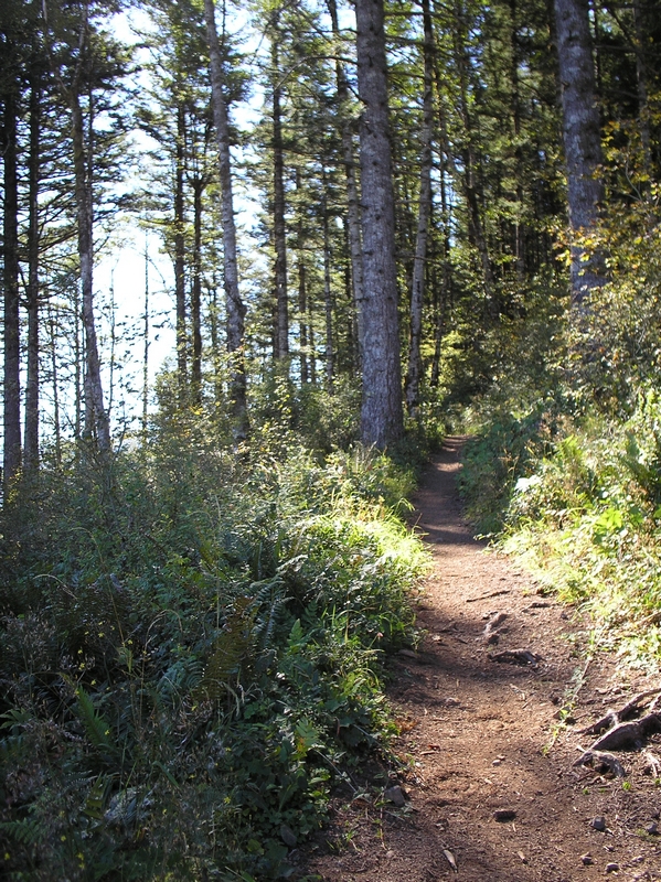
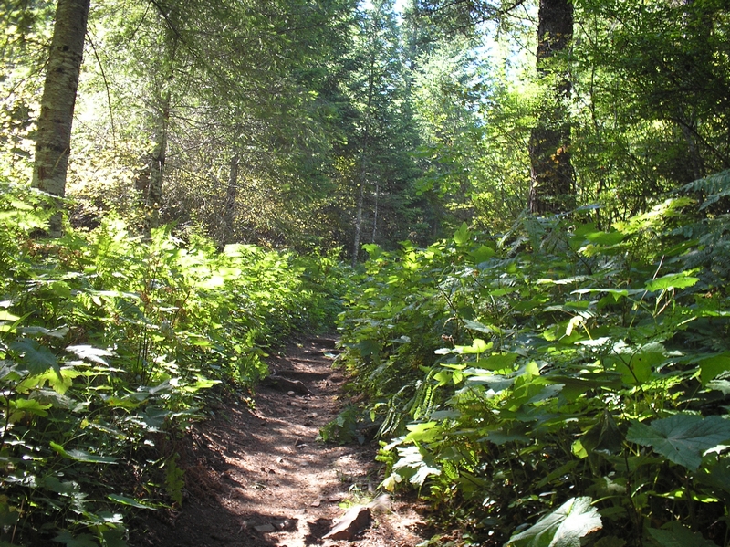
From the information sign, the trail circles to the east of a clear cut. The forest management did leave a few trees along the trail, but both sides of the trail have been clear-cut. The trail starts an ascent right away with lots of rock and roots to negotiate. There are mileage markers every half-mile. The trail enters into a forest area about three quarters of a mile. There is a switchback here that I have never been able to get past without having to dismount. I have the same problem on the way down. I have tried to ride it but I ended up going over the handlebars and putting a nice gouge in the palm of my hand when I landed. It's just the way the rocks form steps when coming down. The rider has to drop off a step and make the turn at the same time. That's what tripped me up, the front wheel twisted and sent me over the front
The trail climbs to another switchback that is easy to make in either direction, then starts to level off some. There is a short level stretch here before the trail cross a forest road. Soon after the crossing the trail starts to climb again. The first two and a half miles of this trail is about 70% up hill. It seems I am almost always in low gear, (smallest) ring gear and the first (largest) sprocket for most all of the climb. The 30% or so that it flattens out is the only chance I get to shift up. This is also the area where the trail well get muddy.
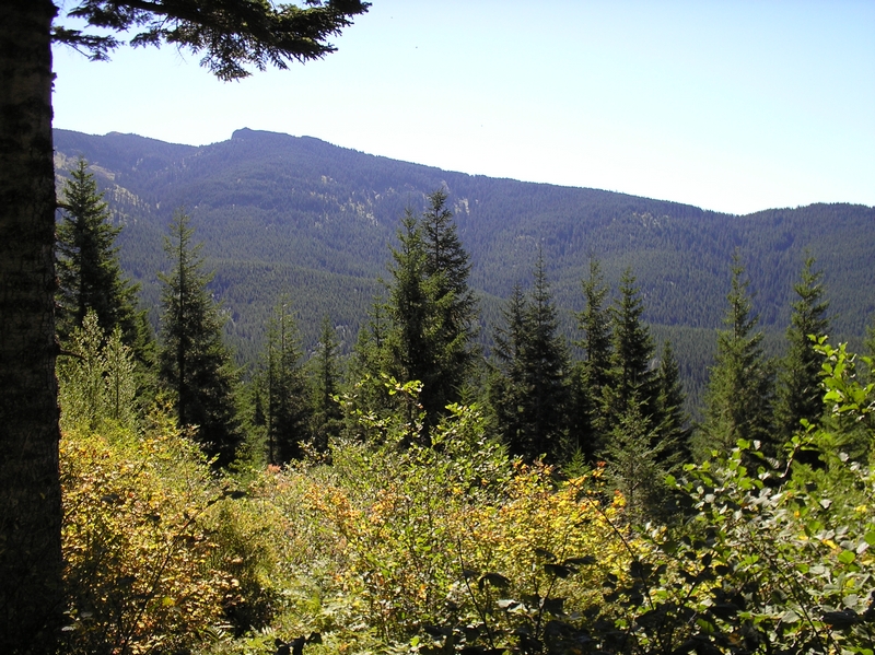
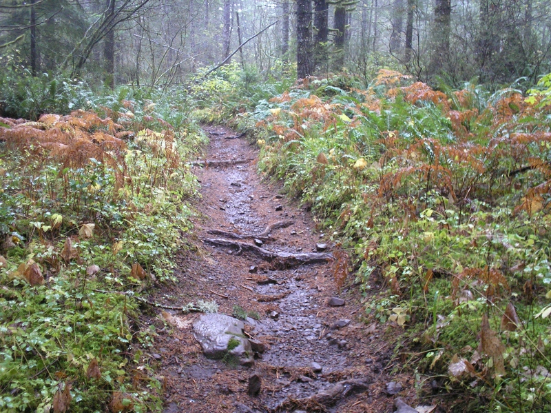
During the wet part of the year the trail along the flat areas in the forest become very mucked up. This is a shared trail and there are a lot of horses I don't think there have been too many times when I have been on the trail when I didn't see a horse and rider. The climbs are unaffected by the horses but the flat areas have lots of sections where the bike rider has to try and traverse large mud holes or ride through them. Toward the top of this section there has recently been some logging. They were good enough to not destroy the trail here and now you have some view instead of that darned old forest.
After about a mile and a half, the trail cross a second forest road, then climbs through the forest for another half mile to another crossing. This one is undeveloped but I can see that dirt bikes have used it, although I have never seen or heard any.
Just a short steep climb and the trail starts to level off. This is the only other place I have to dismount and walk the bike, or should say maneuver the bike over a very large root crossing the top of a short steep ascent. I have never ridden down this part ether because it is a sharp turn with a good foot of drop before descending down a strong slop.
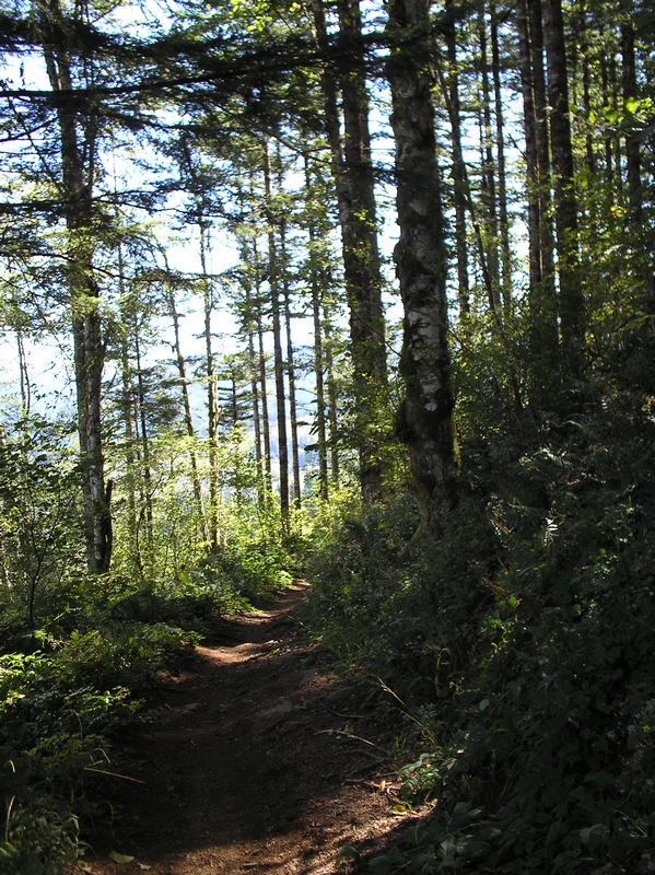
At the two and a half mile marker the trail starts running parallel to the hillside. The first time I rode up here this was the place I turned around and rode back. The return trip from here is fast and exciting with lots of turns where the trail is banked as you round corners on the descent. Swerving around rocks and dropping over roots, I always ride down this with my weight way back on the bike
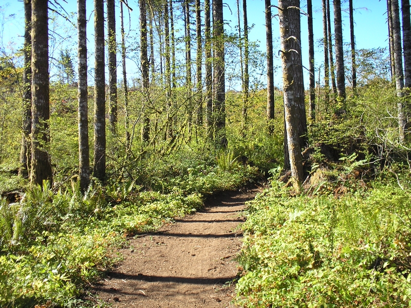
Ridding along here feels to me almost like I am ridding down hill in both directions. It is because the trail makes lots of small climbs and descents. The ride here is fast and for me almost all if it is in second ring gear and third sprocket. The short climbs are small enough that I can make most of them by just standing up and making a few small hard pushes to the top then shoot down the trail. Making this section of the ride in short bursts. There are a few areas that I have to shift gears but most of the ride for me is done in one or two gears. Again the logging has taken a toll here. My last ride up here was in the summer of 09 and they were logging on both sides of the trail. I had never noticed how steep the side slope was until the trees were removed
The trail crosses some grassy brush covered hillside areas, and used to cross back and forth through forested areas. Finally crossing a small spring area and back into the forest to an intersection with the Chinook trail. There is one other trail intersection along this part of the trail, but it is unmarked. The Chinook trail, as I understand is actually a trail made up of a number of trails, starting with Bells Mountain trail, then Tarbell, then this short connection that runs up to Silver Star Mountain trail and on to another. I have ridden from here up to the Silver Star trail and would not suggest it. The first 1/2 mile or so is not too bad but then the trail becomes very rocky. The trail is large lose rubble and rocks, it is very hard ridding, mostly hike a bike up. The views are exceptional though and once the rock and rubble starts the area becomes very alpine like with large rock outcroppings above. There is one place just before the intersection with the Silver Star trail that the trail meanders around and over a very large outcropping. The ride down is also very sketchy, it was so rough that I broke one of my saddle stays (the support bar under the seat where the seat post attaches) and made the last half on one bun.
This intersection has also served as a turnaround point, makes a nice little eight mile ride. Past the trail intersection about another half mile and the trail descends down some switchbacks. On one ride in late fall, after descending the switchbacks, I found myself ridding down a small stream. A small culvert that goes under the trail had plugged up and the stream had turned and gone down the trail for a hundred feet or so. I didn't want to stop because I would have been ankle deep in rushing water so I road it out. As the stream disappeared into the woods, it formed a puddle that was about a foot deep and each peddle stroke had me dipping my feet in the puddle. On my way back I carried my bike up through the woods until I could jump across the stream and remount my bike.
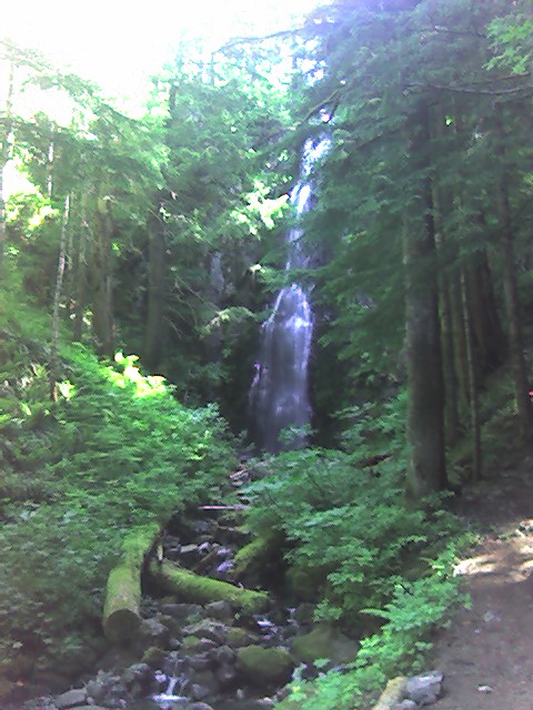
The trail crosses a fork of Coyote creek here and there is a small falls but the real falls is another mile and a half or so.
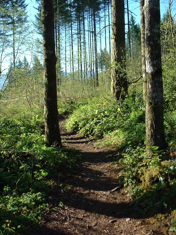
The trail heads west and around a ridge. Nice smooth mostly flat stuff here, soon to reach a few more switchbacks. This portion of the trail was on my last ride very nice timber. The downhill here just good cruising, with easy switchbacks in both directions. In fact the climb up is probably the best uphill on the trail. I can make both, I think there were only two, switchbacks going up. Where that last section of switchbacks I have never made all of them, they are sharp with a lot of rocks. Finally the trail gets to Hidden Falls and this is a good place to turn around. The out and back is 14 miles and this is a good spot to take a break. I have not ridden from here over the top of the next ridge since they logged it a few years back but everyone I have talked to says it is mostly hike a bike through the clear cut.
Trail Ride Report 2007
Trail Ride Report 2011