
McKenzie River Trail No.3507
Difficulty: Modierate to Difficult
Suggested Skill Level: Intermediate to Advanced
Trailhead longitude and latitude: 44 23 20N, 122 00 04W
Google Trail Head Location
 Google Directions From Portland
Description of Ride:
McKenzie River TrailI made this ride with the PUMP bike club. They do an annual ride that is open to anyone and I decided to go. The club had posted a notification of the ride that stated it was mostly downhill. In fact it is mostly downhill. It is not an easy ride. The lava beds take a real toll on most riders. (Since this writing the PUMP bike club has morphed into the Northwest Trail Alliance and they no longer use the phrase mostly downhill. They instead are much clearer on the requirements of individuals riding in this event.)
I arrived at the Paradise camp grounds and arranged to shuttle with one of the organizers of the event. There were several vehicles carrying people and bikes up to the trail head that started just north of Clear Lake
We rode for a little over a mile through the timber to the east end of Clear Lake and the group made a decision there to ride around clear lake. Normally the route is along the west side of the lake and I took this route on a subsequent ride. It is the preferred route. It is a tree covered forest path which wanders past cabins and camping areas. It is very manageable.
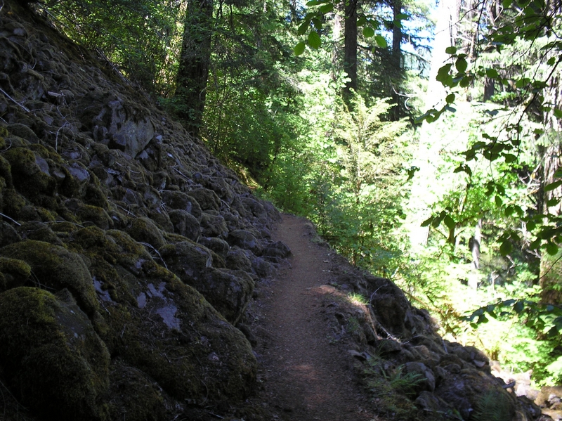
The route around the east side of the lake takes in a large section of lava, and was somewhat challenging for many of the riders. It starts off with more tree covered forest trail, than breaks into a lava field. The lava is very coarse and there are many places where we had to mount short burst attacks to climb up and over a small incline. There were many areas where we had to maneuver down small steep slopes, weaving through the lava lumps. Maintaining balance, not over steering, not applying too much brake, and with just enough speed to clear that section. Then there were sections were many of us just had to step off and walk our bikes.
After the trail merges back into the main McKenzie River Trail, it runs for another quarter to half mile and crosses highway 126. From here the trail starts to descend.
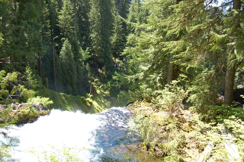
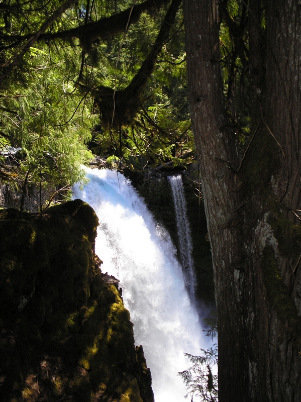
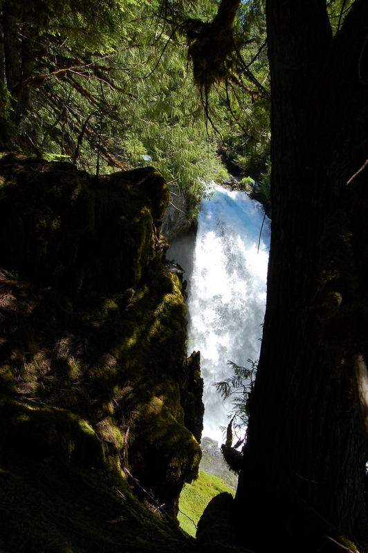
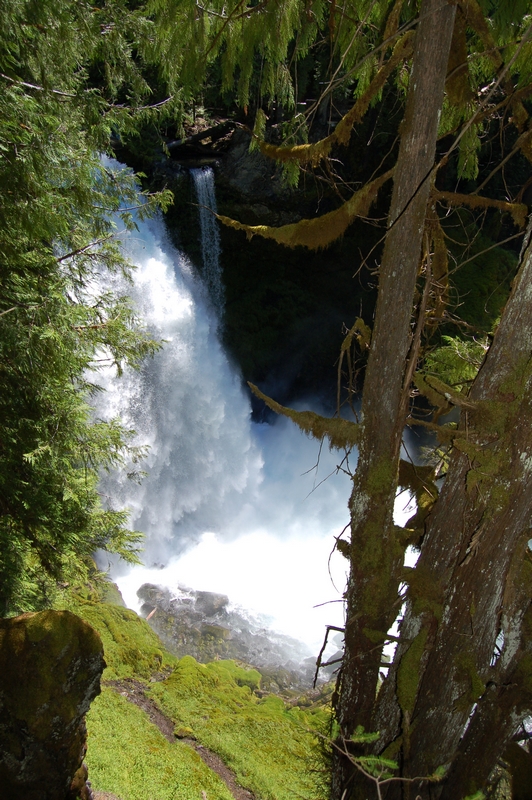
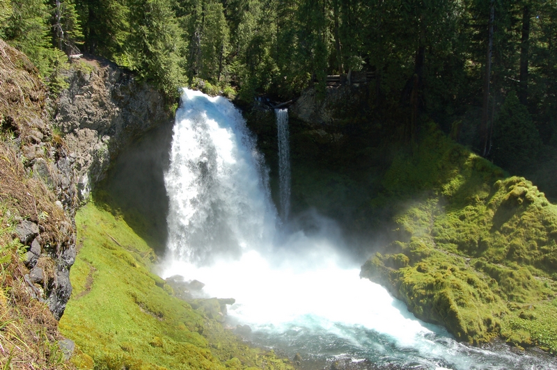
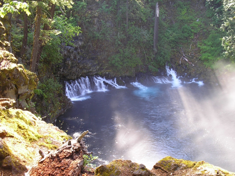
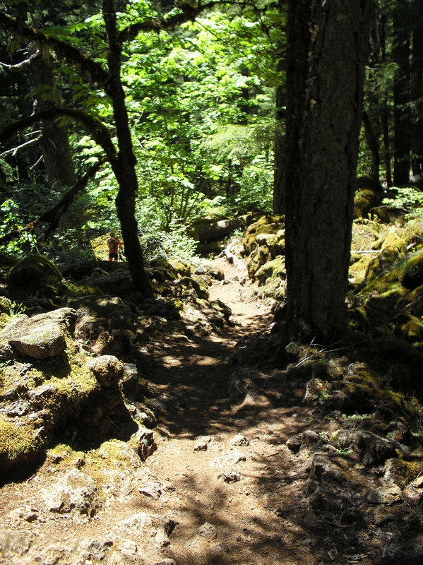
The trail for the next four miles or so weaves back and forth through the forest as it descends. The path is rough with lots of tree roots and rocky lava descents. There are some spectacular views of the river and a couple of truly awe-inspiring waterfalls.
The group stopped at Sahalie Falls for a break and let everyone catch up. Standing on the top of a sheer drop, looking at these waterfalls is a fantastic diversion from the trail.
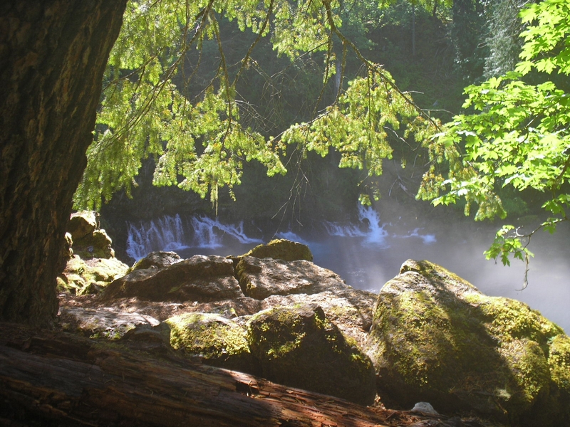
While talking to one of the other riders, I found out that the McKenzie River goes under ground for a few miles and re-emerges at a place called the blue pool.
The rough descent ended about the time we lost the river. I guess this is where it goes under ground. The ride here was across leveler terrain, although there were lots of twists and turns and a couple of small bridges.
The next stop was the Blue Pool.
The Blue Pool is where the McKenzie River re-emerges from the lava. It is the most tropical blue I have ever seen in the northwest.
The group again stopped for a break, many people ate their lunch here and as a group, things kind of fell apart. Many leaving just as the last of the group arrived. From here on the ride was fragmented with riders of all skill levels spread out over the next eighteen miles.
There were also riders showing up at the blue pool that had started in the early morning group and were doing an out and back ride.
The Blue Pool is where I ate lunch. Sitting atop a rocky lava outcroppings above the Blue Pool. A magnificent place, well worth the hike or ride in just to look at (2 miles from the nearest road).
When I took off there were two other riders leaving at the same time. The one who left first was doing a lot of hike-a-bike through this area, and after about a quarter of a mile, he stopped at an overlook. We talked for a few minutes and he said that he felt this area was the hardest for him along the trail.
We were making our way across a very challenging lava field and the trail was very coarse. I got off my bike probably 6 to 8 times and walked it down through a narrow descent made up of sharp jutting lava outcroppings and lose lava boulders.
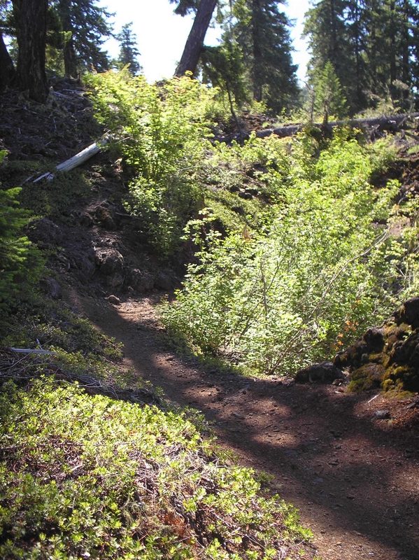
After about a half mile or so the trail began to smooth out and became a forest trail, hard packed dirt covered with a thin layer of fir needles.
At about eight miles there was a road intersecting the trail.
I was riding alone now and had heard there was a place to get water along here. Both my water bottles were empty and I didn't want to miss that spot. I rode down the road a ways and didn't see any where to get water and I didn't see any camping, just half a dozen or so vehicles parked in the area.
I decided to go back to the trail and wait until I found someone who knew the route.
As I waited a couple showed up in a pickup and parked. As they passed me on their way to the Blue Pool, I asked if they knew where there was any water. They didn't but he offered to go back to his pickup and get me a beer. I thanked him, but said I was good.
Soon a couple of riders showed up and we headed down the trail toward the campground with the water
The trail, after crossing the road, climbs, gaining a couple hundred feet of elevation. Then it descends to the campground. It was another two miles.
At the ten mile mark there is a place to get water. It is the Trail Bridge campground. The water spigot is located off the trail a few hundred feet toward the river.
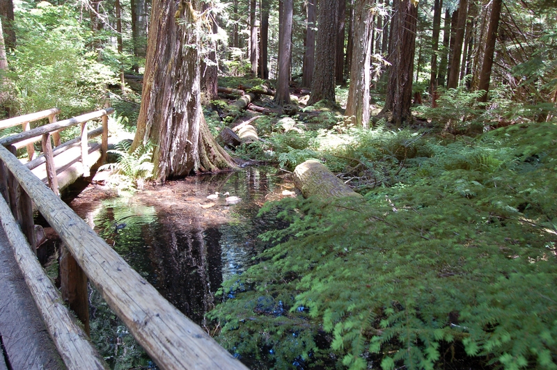
When I picked the trail back up, it descended down to a stream. There is a narrow log bridge to cross and then the trail climbs back up and around the ridge.
The trail follows the river, elevated high above it for the next couple of miles.
There are many areas along here where the trail traverses steep hillsides, the river rushing just below.
Although the trail is somewhat narrow and the hillside has a somewhat extreme angle to it, the ride is mostly smooth and fast paced. Small short climbs now and then, but for the most part level or downhill. Not so much downhill that you can coast all the way, but downhill so that as you peddle there is almost no resistance.
On my second ride down this trail, I came around a bend just as the trail approached the river and hit an overhanging tree with my shoulder. This knocked me off balance and I had to drop from my bike to my feet as I applied the brakes. My stop was just inches from the edge of the trail and what would have been a rough tumble.
The rivers path moves away from the steep hillside and the terrain becomes flatter. The trail is still mostly a downhill run, light peddling with a couple of small uphill climbs.
After a couple more miles there is a forest road that the trail crosses then soon after that a creek crossing.
Then the trail moves up onto a road for about half a mile. This section being very easy to ride.
At the end of the section of double track (road) there is a gate and the trail drops back into the woods.
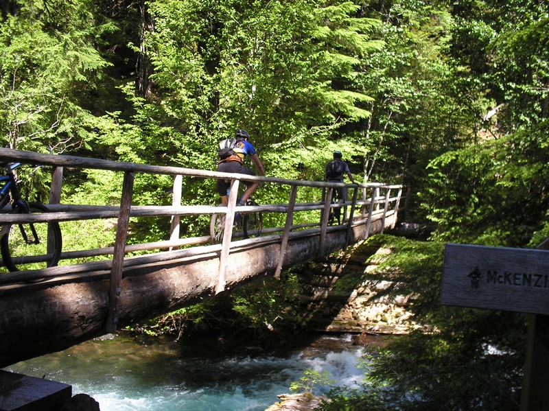
The bridge crossings are all single log bridges with a guard rail on one side. I would suggest when crossing these types of bridges, just stand the bike up on the back wheel and guide it across, holding the handle bars just as you would if you were riding.
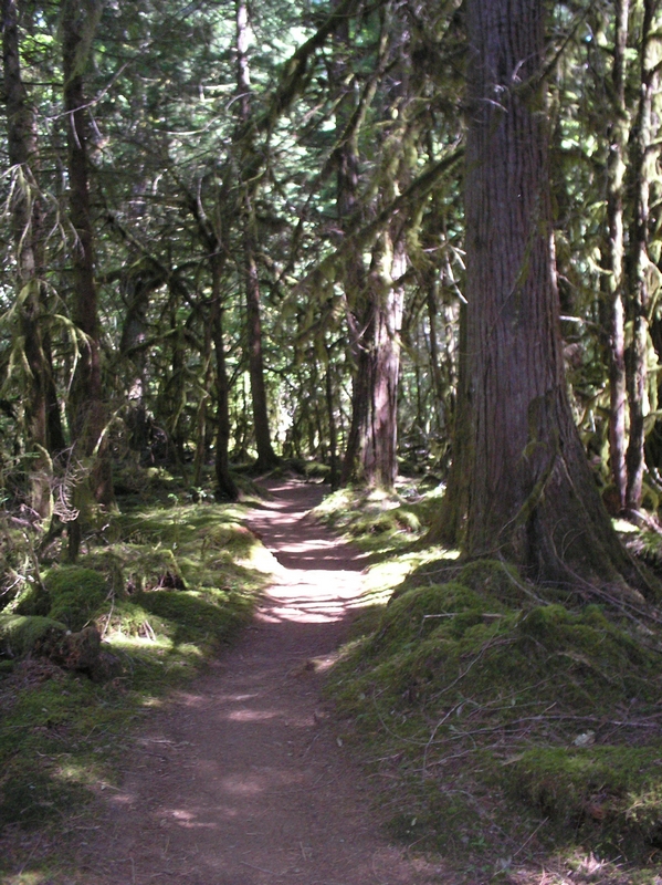
More of the same well defined moderately wide trail that is easy to ride. A few slightly technical spots running amongst tree roots and rocks.
The trail is soon intersected by a forest road at the point that it crosses to the south side of the river.
This is an easy place to get misguided. I did not see any signs, and there were two exits from the woods. The trail split just as the road became visible from the forest. Both sections of trail crossed the road and looked "kinda" like they were the trail.
I picked up the trail just a few feet from the south end of the bridge. That is after a couple of false starts down through the woods on the north side of the river.
The false trails on the north side of the river are trails, fisherman trails.
When you look across the bride, highway 126 is so close to the river it doesn't look as though a trail could be over there, but it is.
The trail runs right next to the road for a ways, the traffic noise is loud, as the cars and trucks roar by.
Back at the forest road crossing I had picked up another rider who was also confused here, we rode along for about a quarter mile until we came to another road.
There was a rider sitting by the trail here and he asked if we knew how much further it was to Paradise. Since neither of us had ridden the trail before we had no answer for him. He joined us as we rode on down the trail.
There was another creek crossing and we hit another road where we met a family on bikes. We asked them if they knew where Paradise was, and they didn't, we rode on.
A very short distance later and we could see a camping area. The trail split here and we rode toward the tents and trailers we could see through the trees.
As we entered the park, we asked some campers if this was Paradise, and they replied that paradise was another five miles down the trail. This was Belknap Park.
Skeptical, or just not wanting to believe we had another five miles to go, we rode on until we ran into a young man and woman walking along the road. When we asked them, the young man told us we had to go back the way we came and pick up the trail outside the park. He said that Paradise campground was a few miles further down the trail.
Paradise, a few more miles, it was indeed. We rode on, the others stopped for some reason, so I kept on at a steady pace. Crossing another bridge and climbing up over another ridge. Thinking at the time this was some beautiful trail and I wish I wasn't so tired, I know I would enjoy it
The last few miles are pristine single track that runs back a ways from the river. I have on other trips ridden out and back rides from Paradise Park and find this trail a lot of fun.
Ride report July 7 2012
