
Stabler Camp Craggy Peak Loop
Difficulty: Moderate
Suggested Skill Level: Beginner to Intermediate
Trailhead latitude and longitude: 46 12 57N, 121 53 56W
Google Trail Head Location
 Google Directions From Portland
Description of Ride:
The ride starts on a spur road that is gated, Rd 9331. This spur comes off of forest road 9300 (also referred to a 93).
Get on your bike and follow the road uphill for two and a quarter miles. To the intersection of the Stabler Camp trail #17.
The ride up the road is an easy consistent climb. It follows the edge of a few clears cuts, and runs through the timber in a couple of places for short sections.
There were tracks from Elk all the way up, and lots of huckleberries ripe and ready for picking alongside the road.
There are good views of Mt St Helens, Mt Adams, and Mt Hood from the road.
I almost missed the trail intersection. The trail sign was missing. Although the trail on the southern side of the road had a post where the sign had been. There is also a creek crossing under the road here.
At Stabler Camp trail, turn left, toward the north.
When I plotted this ride out, I was expecting to see a huge climb here. My software and the forest service map, both showed an ascent here of at least a couple of hundred feet. So when I looked up the trail and saw a sharp climb I was not surprised.
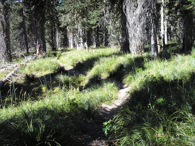
What did surprise me was that just a couple a hundred feet up the trail and it flattened out. The next half mile was an almost level ride. A very nice ride on a single track through a high elevation forest.
The trees along the trail were consistently small in size. There were lots of meadows and bear grass clearings. The trail or tread was mostly coarse ash, but fairly well packed and not difficult to ride.
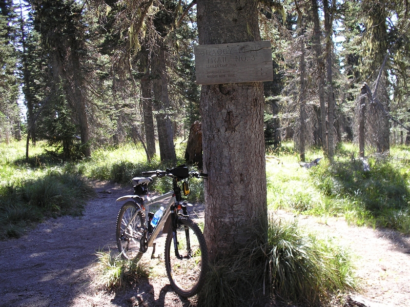
After a half a mile, the trail intersects Craggy Peak trail #3.
Craggy Peak trail is open to motor cycles, horses, mountain bikes, and hikers.
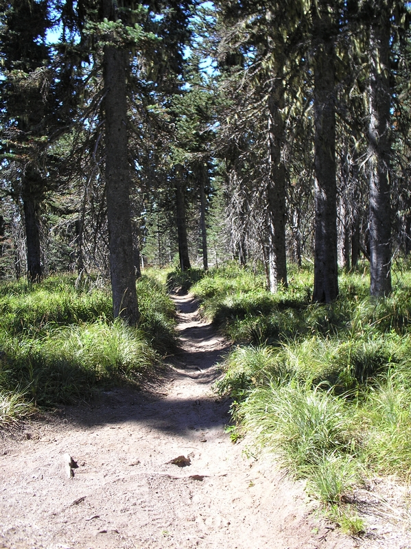
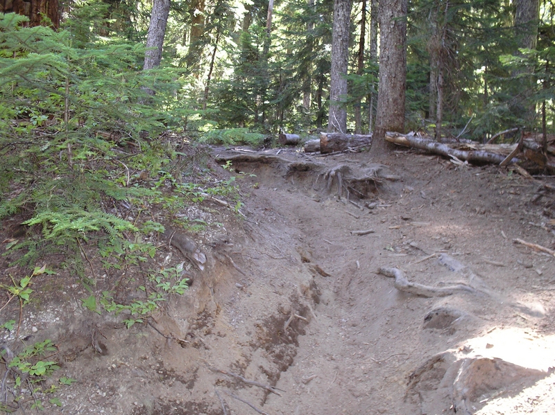
Much of the trail is rutted from the motor cycles and horses and although the ruts are deep in places, it is still very ride able downhill. I don't think I would even try riding up the trail, a steep rut with countless root wad steeps.
Even though this is on the edge of the blast zone, the ash was not a real factor in this part of the ride.
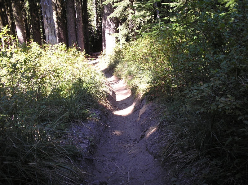
I have to say it was a great downhill run. I am a somewhat cautious rider, but only had to stop and dismount a couple of times because of large drops across root wads. For the most part I screamed down the hill, through the forest, across open slopes and meadows for the next two and a half miles.
The last half mile did have a few sketchy points. The trail transverses a steep hillside. It was not real narrow, but there was a rut about six inches wide and a couple of inches deep and it was very soft on either side. If my bike wandered out of the rut, it felt like I could lose control and plummet over the embankment or crash into the hill on the upward side. I held fast though and only stopped in one place. The dust from my bike catching up and overtaking me when I did so.
Just as the trail entered back into the forest, I came to Wright Meadow trail #80.
It was just about three quarters of a mile back to forest road 93 on Wright Meadow trail. A forest trail, mostly uphill at a moderate grade.
The trail has very loose soil, with lots of exposed roots. First, second, and third gear all the way back. The trail has been used a lot by horses and horses tear a trail up worse that anything.
The return to the car is about a quarter mile along forest road 93.
This ride was a short loop a lot of fun but short.
It looks like from the map that this ride could be extended another four miles or so, and take in blue lake. The rider would have to continue up the road another three quarters of a mile to the trail head for trail #3A. This trial looks like it is about two and a half to three miles in length and joins Craggy Peak trail #3 a couple of miles Northeast of where I picked up the trail. I have read a couple of accounts of the trail to Blue Lake from Craggy Peak trail and it sounds like a rough steep trail.
